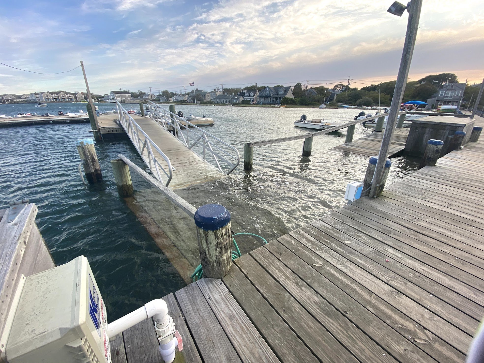
Town Pier/ Nantucket Harbor
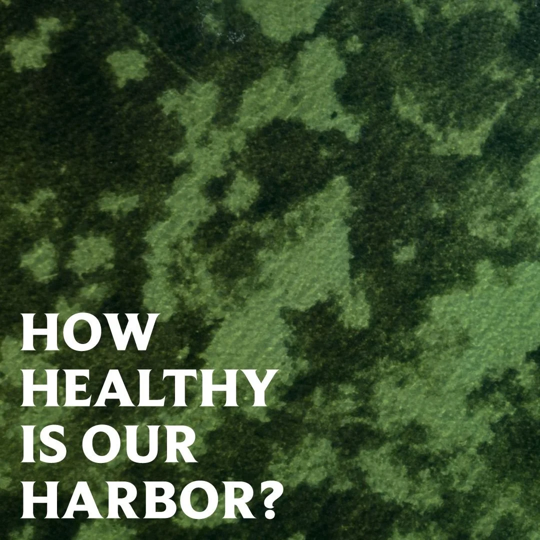
Nantucket Harbor is in many ways the heart of our island. It is our primary point of access, the physical center of our economic and cultural space, and the home of critical natural resources that support local industries, but is experiencing more extreme eutrophication and algal blooms as a result of nutrient pollution. The shape of Nantucket Harbor and the Jetties allow for long water residency times and tidal stacking during storms (water gets caught in the harbor and can not leave). Our harbor contains the last commercially sustaining bay scallop fishery in the world but is experiencing eelgrass and habitat loss, water quality degradation, and harmful algae blooms. We are facing a critical tipping point and what we do on land directly effects the Harbor- either positive or negative. The choice is ours.
Photo courtesy of Kim Rose
Past
-
![]()
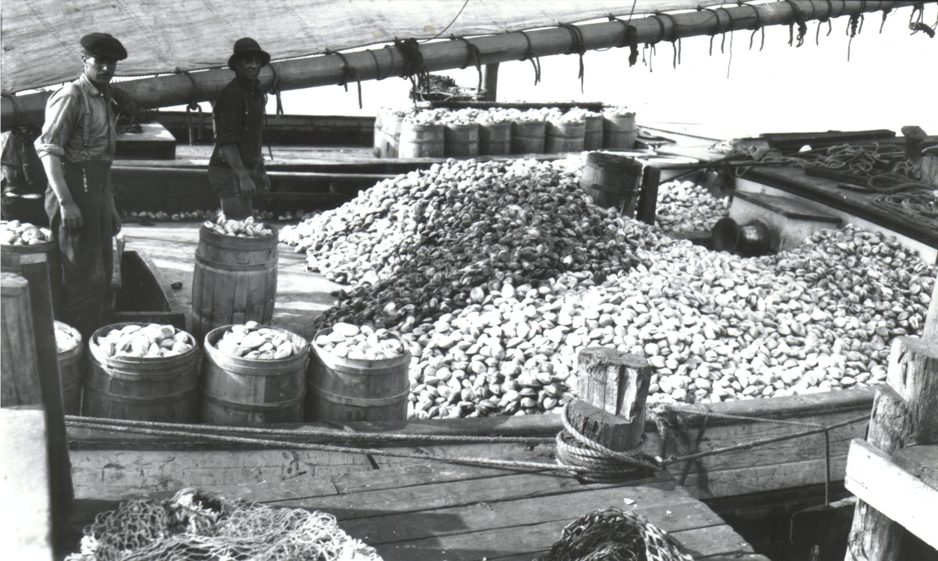
Quahog Country
Quahog dragger at Steamboat Wharf, with a load of clams onboard. Without limits imposed, fishermen filled their boats with as many clams as they could take. Two years after a huge bed of quahogs was discovered north of the Jetties in 1913, a Nantucket fish packing company set a record of fish exported to the mainland. (Courtesy of the Nantucket Historical Association.)
-
![]()
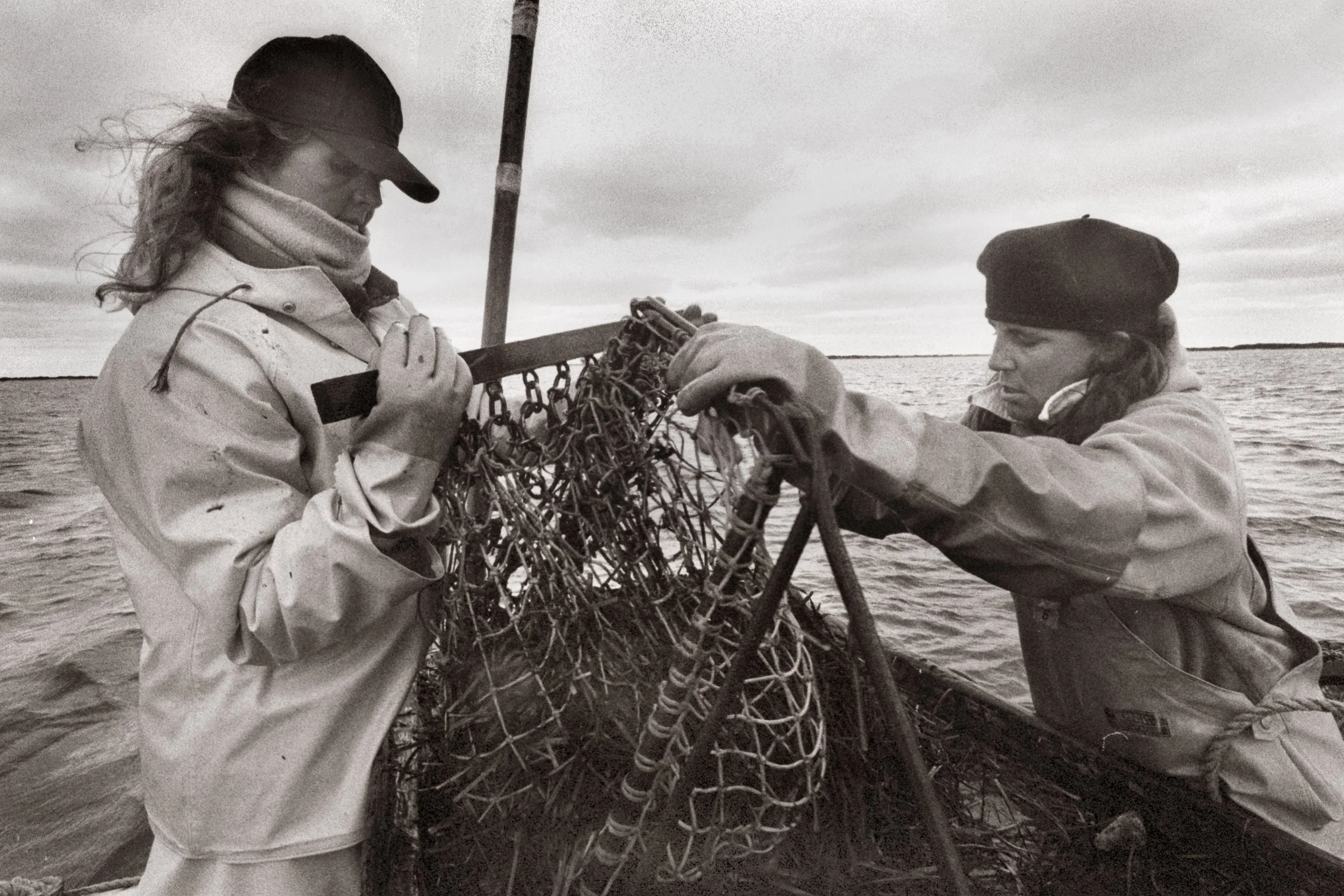
A Fishery at Risk
Scalloping continues to be a lucrative source of seasonal income for many Nantucketers. However, fertilizer runoff, other pollutants, and over-fishing have endangered this traditional occupation. In this photograph, Linda Herrick and Leslie Johnson adjust their dredges in 1992. (Courtesy of the Nantucket Historical Association, photo by Rob Benchley.)
-
![]()
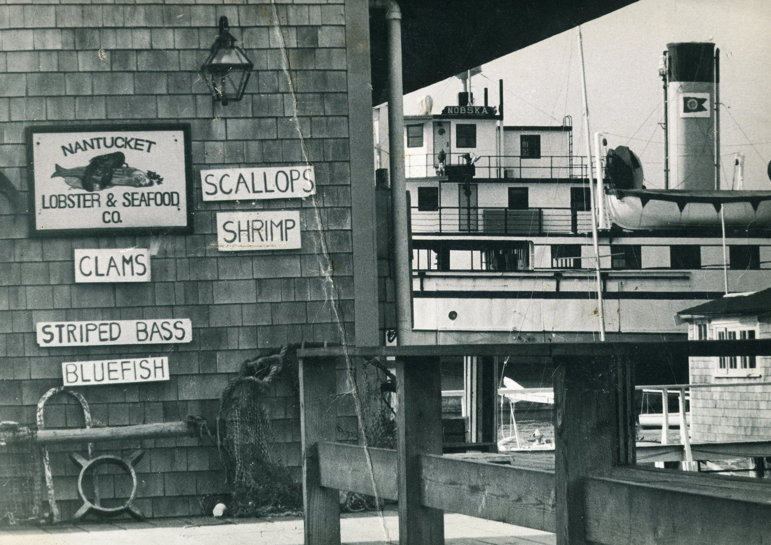
Fish Market on the Docks
The Nantucket Lobster & Seafood Co. fish market on Straight Wharf. Signs on the building advertise fresh seafood including clams, scallops, shrimp, bluefish and striped bass. The Nobska is docked in the background. Courtesy of the Nantucket Historical Association.
-
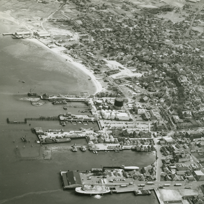
![]()
The Boat Basin Under Construction
1968 Close up aerial view of the town shoreline, looking south from Easton Street to the Creeks. Cyrus Peirce school is just visible at the top right of the image. Courtesy of the Nantucket Historical Association.
-
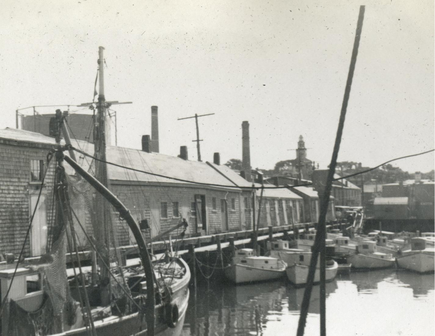
![]()
Fishing Fleet
"Around the Docks", Old South Wharf with docked fishing boats, including motorized catboats. Photo from album made by Jean Burrell Beinecke. Courtesy of the Nantucket Historical Association.
-
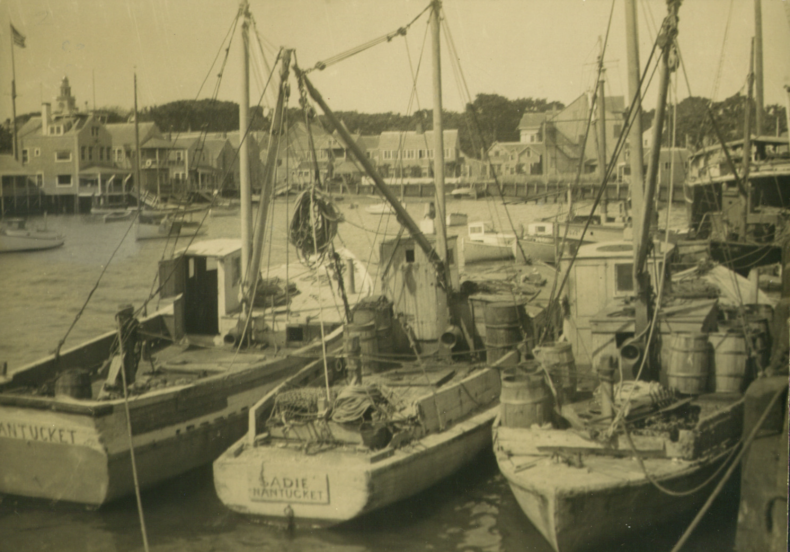
![]()
Fishing Boats Three Deep
Photo of three fishing boats in the Easy Street Boat Basin. One boat is the Sadie of Nantucket. Old North Wharf is in the background. Courtesy of the Nantucket Historical Association.
-
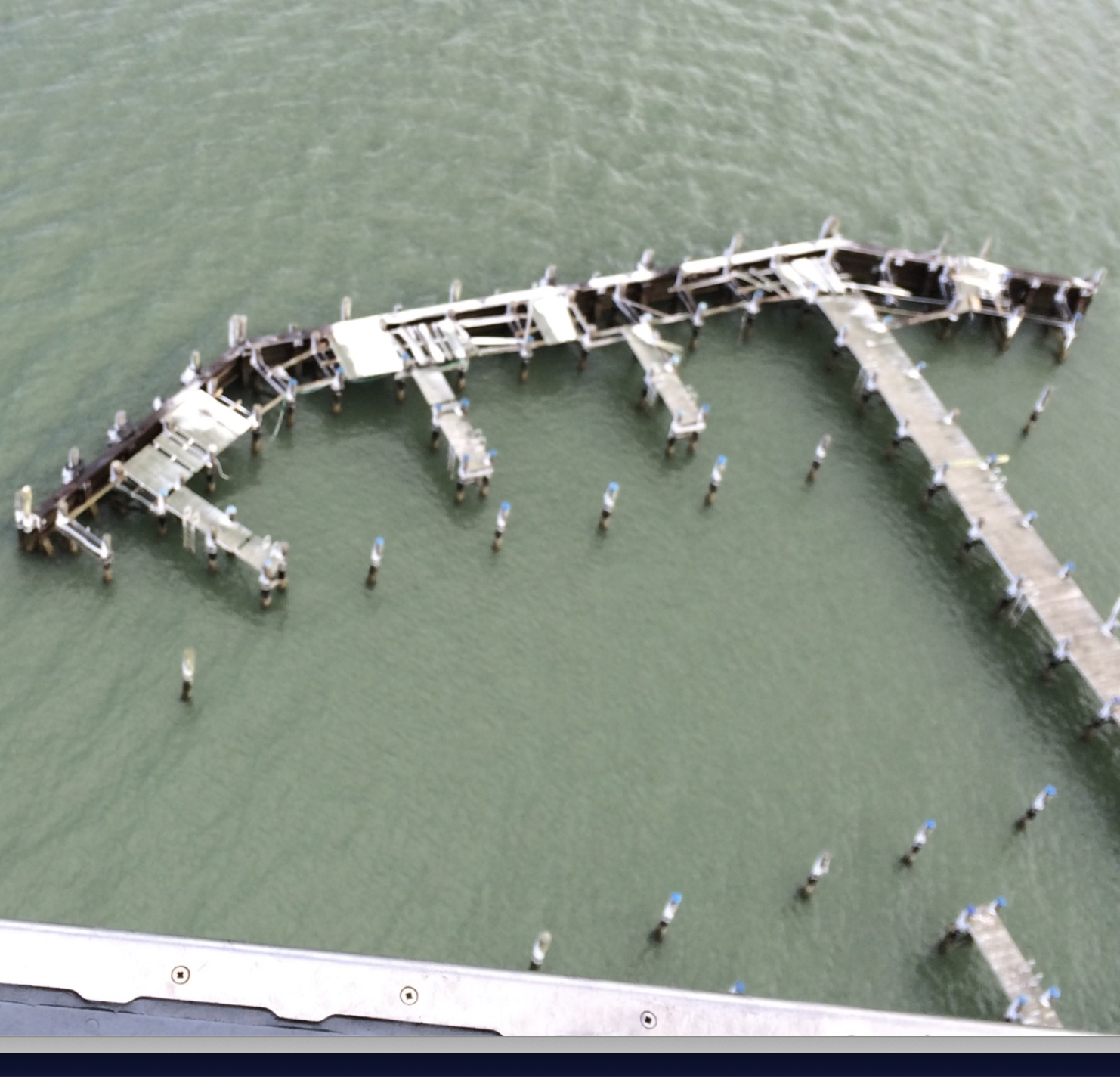
![]()
Winter Storm Damage
Winter Storm Juno caused an estimated $996,224 in damaged to the Town Pier in 2015. In addition to the financial costs, Conservation Commission and Army Corps of Engineer permits were required to repair the damage. (Courtesy of the Town of Nantucket)
Present
Images from the Clean Water Coalition Campaign
-
![]()
The Clean Water Coalition is a group of island organizations and entities that have identified clean water as a critical issue for Nantucket. Each group represented considers healthy water resources an essential element to our diverse interests and missions. They also recognize that moving the agenda of improving water quality conditions forward, in our harbors and ponds, is a monumental task that will require public private partnerships and broad community support. Image courtesy Tucker Finerty
-
![]()
The Town of Nantucket has worked with the community to enact policies and regulations relative to these nutrient sources. Water quality has stabilized, and in some cases improved, in some of our waters, however the ecosystems still show significant decline. A great deal of monitoring, research, and many restoration efforts are ongoing, however, we must all continue to focus on addressing the sources of the problem. Image courtesy Tucker Finerty
-
![]()
Nantucket’s freshwater ponds and harbors are experiencing more extreme eutrophication and harmful algal blooms as a result of nutrient pollution. While nutrients like Nitrogen and Phosphorus help plants grow, too much of a “good thing” in the wrong environment can wreak havoc. Too much P in freshwater and too much N in saltwater supports algal growth leading to depleted oxygen levels, depleted sunlight, fish kills, and in some cases the algae can produce toxins harmful to people and pets. Image courtesy Nantucket Land and Water Council
-
![]()
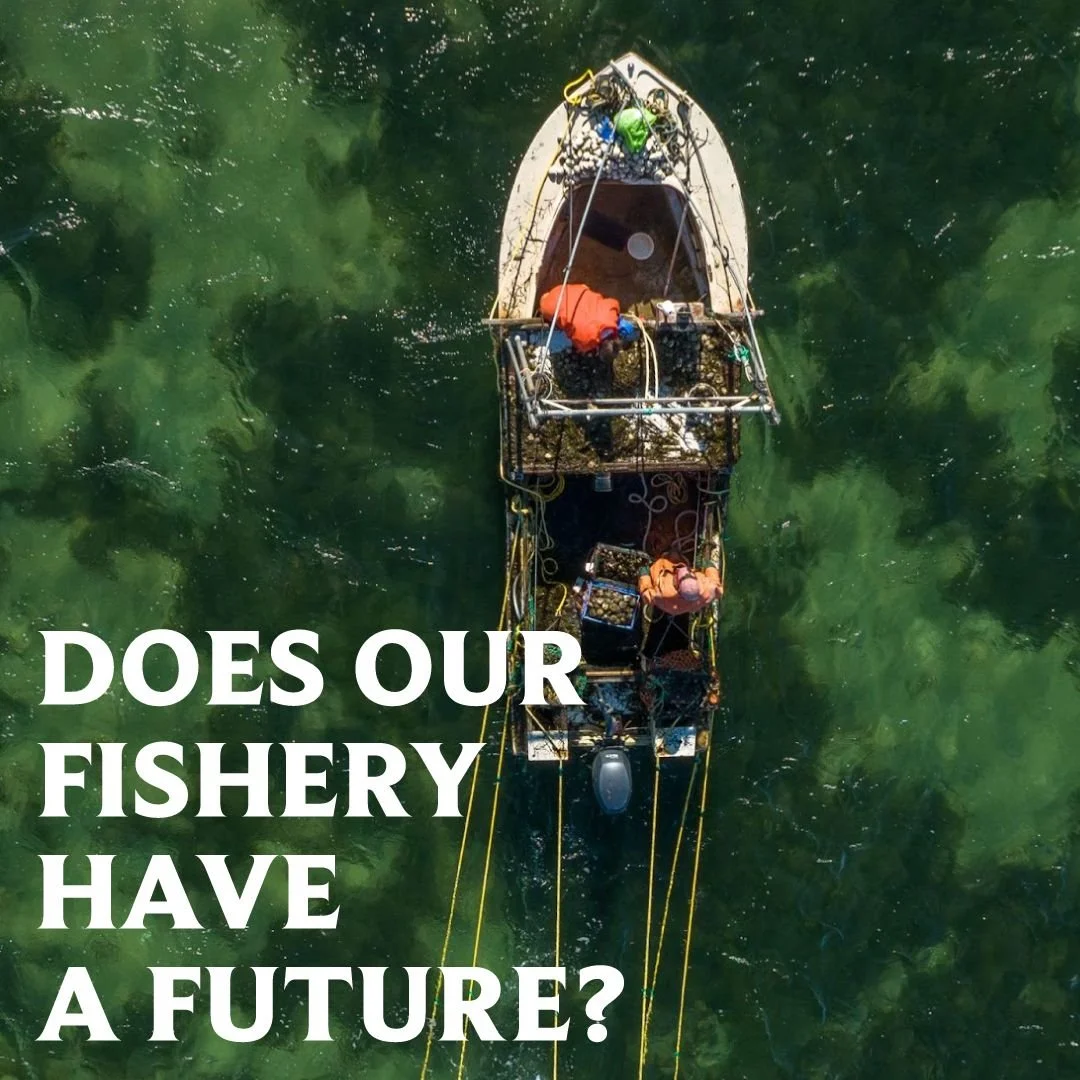
Eelgrass habitat continues to decline, and macro-algal abundance has increased, both indicative of a nitrogen enriched system. Since the 1980’s scallop yields have declined significantly due to less fishermen and lower scallop populations. In 2022 the scallop yield was at an all-time low of 3,200 bushels. Image courtesy Henry Michaelis
Future(s)
These conceptual renderings are illustrative of potential long-term resilience strategies and do not represent final designs or near-term recommendations. These are presented to help inform community discussions about long-term adaptation.
The future remains up to us.
-
![]()
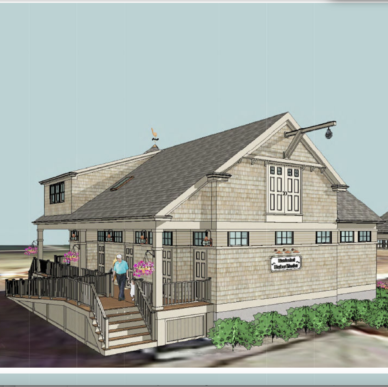
Replacing the Harbormaster Building
The Town of Nantucket is planning to replace the existing 1960’s Harbormaster building with a new facility at its current location at 34 Washington Street adjacent to the Town Pier, which is also undergoing much needed renovations. An appropriation of $3,450,000 was approved in Article 17 of the Town’s 2018 Annual Town Meeting for the project. The Town received a grant award of $1,000,000 from the Massachusetts Seaport Economic Council for this project in August 2018. Coastal Engineering Company won a competitive bid for the project and is working with Stephen Kelleher Architects to design a 3,400-square-foot, two-story structure that meets the historic district as well as a FEMA velocity zone requirements. (Photo courtesy of the Town of Nantucket)
-
![]()
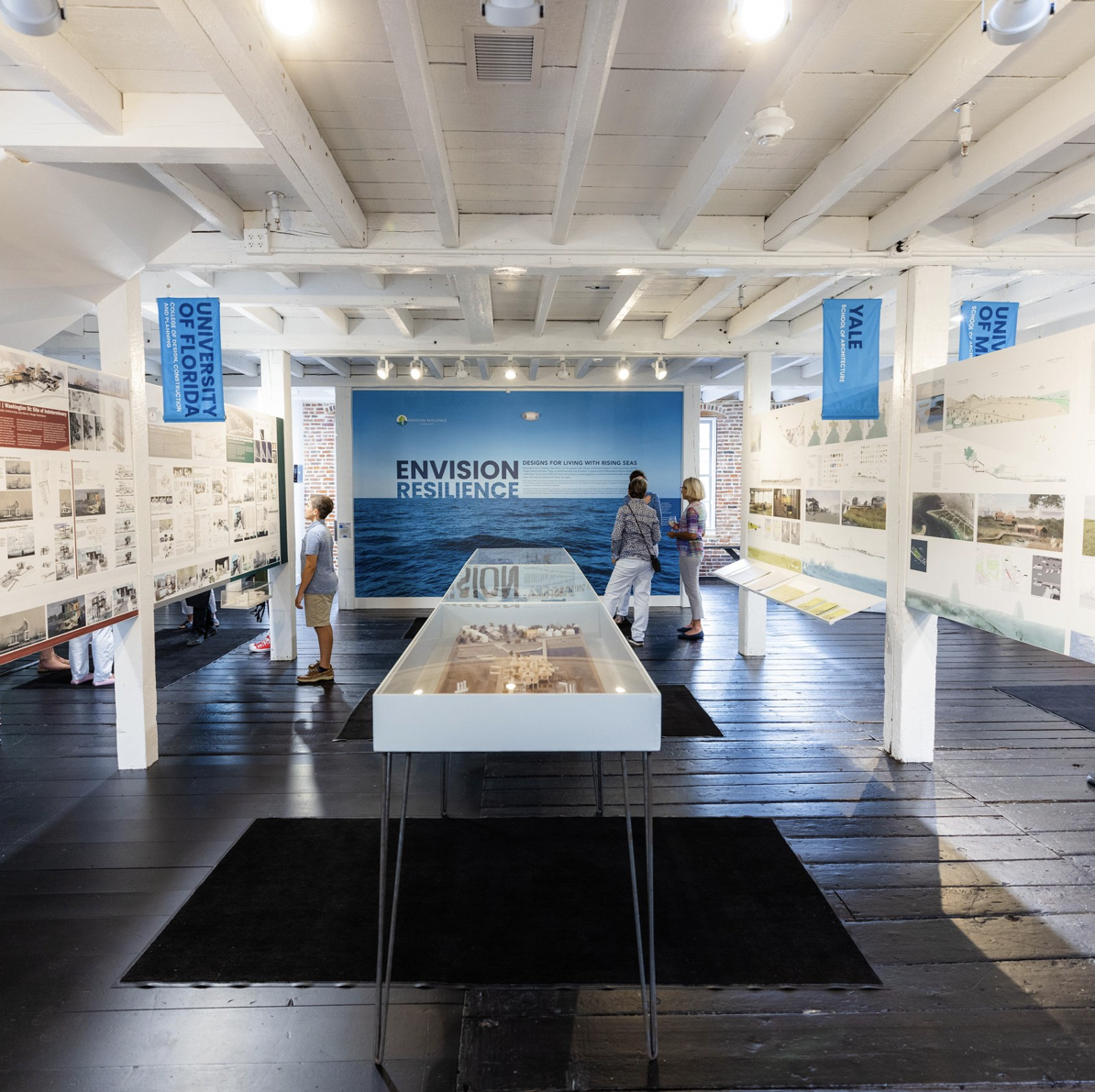
Envision Resilience Projects
In the Spring of 2021 ReMain Nantucket convened a group of more than 20 local and regional advisors to bring expertise in conservation, public works, real estate, architecture, historic preservation, natural resources, marine biology, fisheries, civil engineering, art, science, and transportation to participating university teams. This interdisciplinary group provided resources and insight as the teams moved through the spring 2021 semester and examined the complex issue of sea level rise on Nantucket. During the 2021 Envision Resilience Nantucket Challenge, the student teams were untethered to local zoning, policy and permitting regulations and encouraged to design big and bold, as you will see in their visionary, out-of-the-box ideas. Though the designs may be far from shovel-ready, they created the space for our community to engage in more positive, hopeful and meaningful conversations about our future.
-
![]()
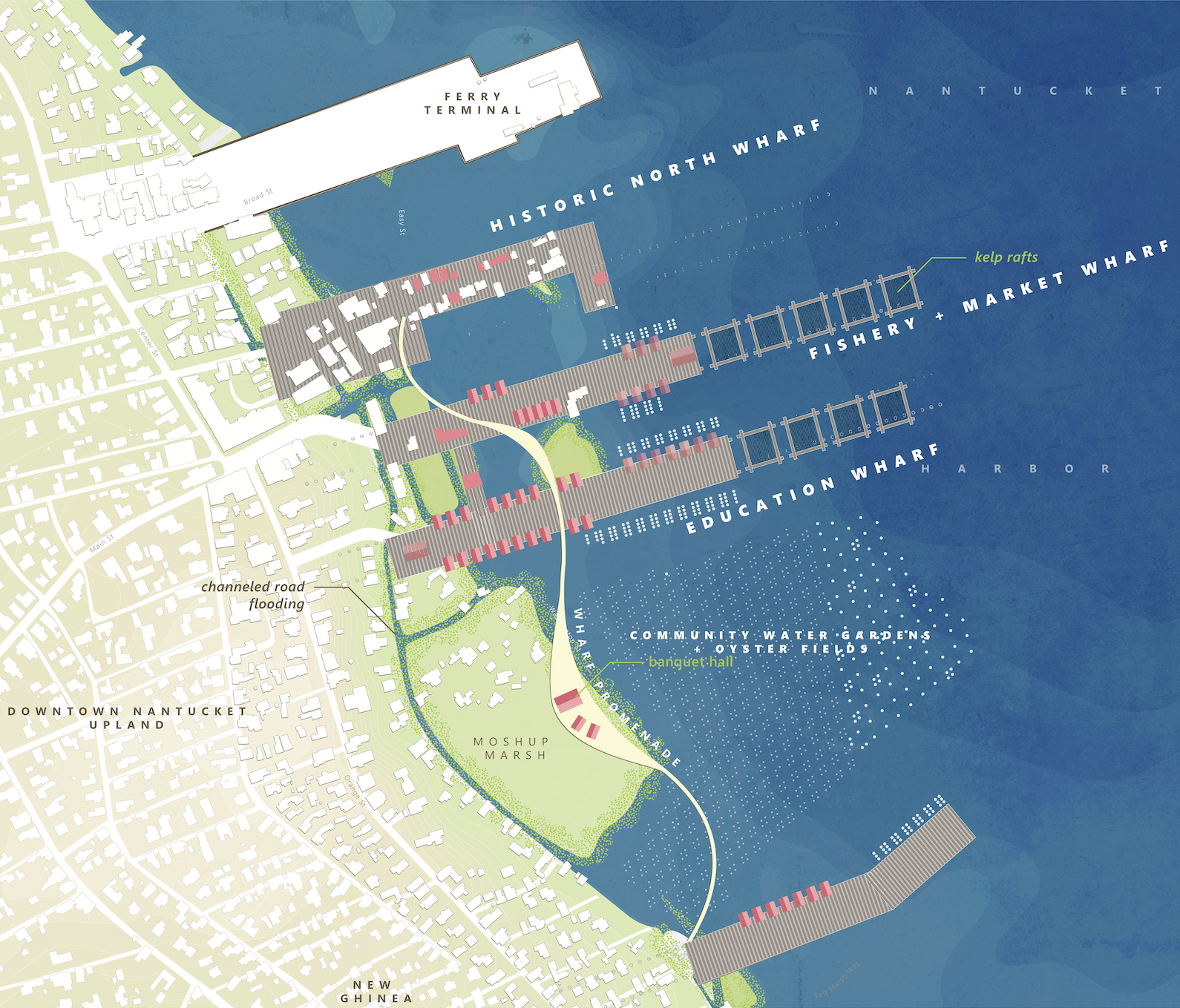
Envision Resilience-Harvard GSD
"Cultivation Chronicles" is part of Harvard GSD's design studio, "Away...Offshore...Adrift...Shifting Landscapes, Unstable Futures" for the 2021 Envision Resilience Nantucket Challenge. Students developed extensive long-term proposals that could take advantage of sea level rise and shifts in tidal currents to improve habitats and accommodate evolving public interests. (Image Courtesy of Envision Resilience)
-
![]()
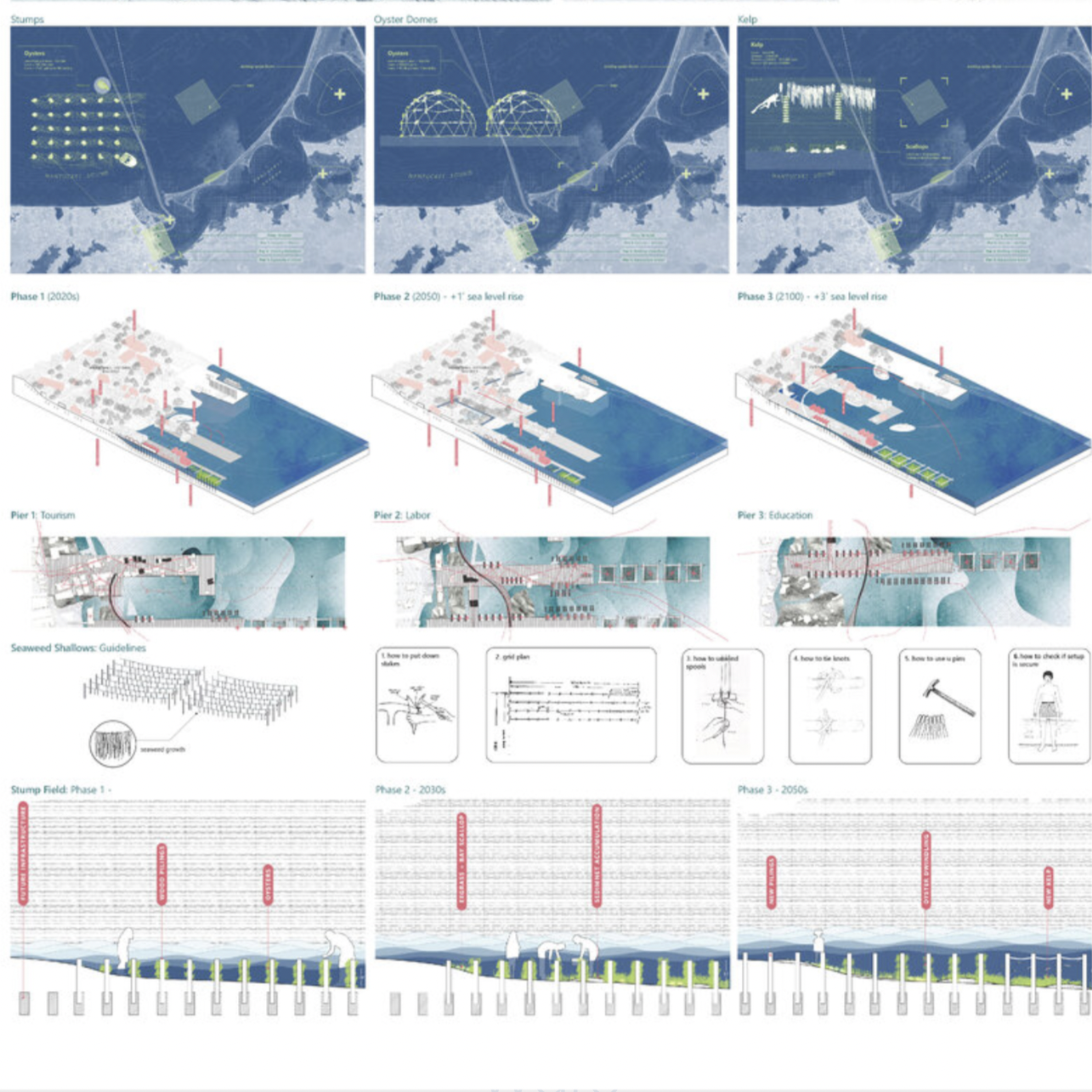
Envision Resilience-Harvard GSD
"Cultivation Chronicles" is part of Harvard GSD's design studio, "Away...Offshore...Adrift...Shifting Landscapes, Unstable Futures" for the 2021 Envision Resilience Nantucket Challenge. Designs proposed sometimes subtle, sometimes dramatic adjustments to the island’s shorelines that would allow Nantucket to evolve productively while sustaining the fundamental identities of the island and its communities. (Image Courtesy of Envision Resilience)