Washington Street
The Washington Street corridor was once a working waterfront for mariners, crafts/tradesman and fishermen, and is now one of Nantucket’s key transportation routes. An abundance of historical photos from the Nantucket Historical Association provide a visual narrative of the evolving shoreline. Today, this waterfront corridor is highly vulnerable to rising sea and ground water levels, as well as increased stormwater flooding. The Land Bank has partnered with SCAPE, Woods Hole Group, ReMain Nantucket, and the Town of Nantucket to conceptualize improvements to this area that will enhance flood storage capacity, public recreation, and healthy coastal habitats, while improving multi-modal access (e.g., biking, walking, driving) to and from downtown.
Courtesy of the Nantucket Historical Association
Past
-
![]()
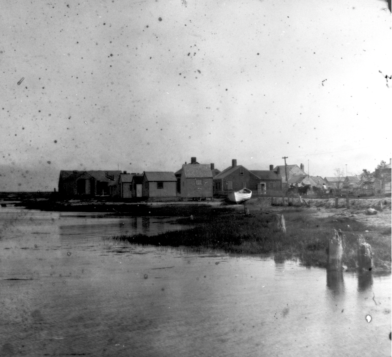
Fishing Shanties
1890s Fishing shanties on the Washington Street shore, with a fishing dray and a couple of dories on the beach. (Courtesy of the Nantucket Historical Association)
-
![]()
1915 Washington Street Overview
View of the train headed south on Washington Street, from the ridge on Orange Street, known as Quanaty Bank. Several houses are in view as well as a ship and several smaller boats in the harbor. Photo by Marshall H Gardiner. Courtesy of the Nantucket Historical Association.
-
![]()
1890s Shoreline
1890s Shoreline along Washington Street, showing small cottages, carriages, dory on shore, and railroad tracks. Courtesy of the Nantucket Historical Association.
-
![]()
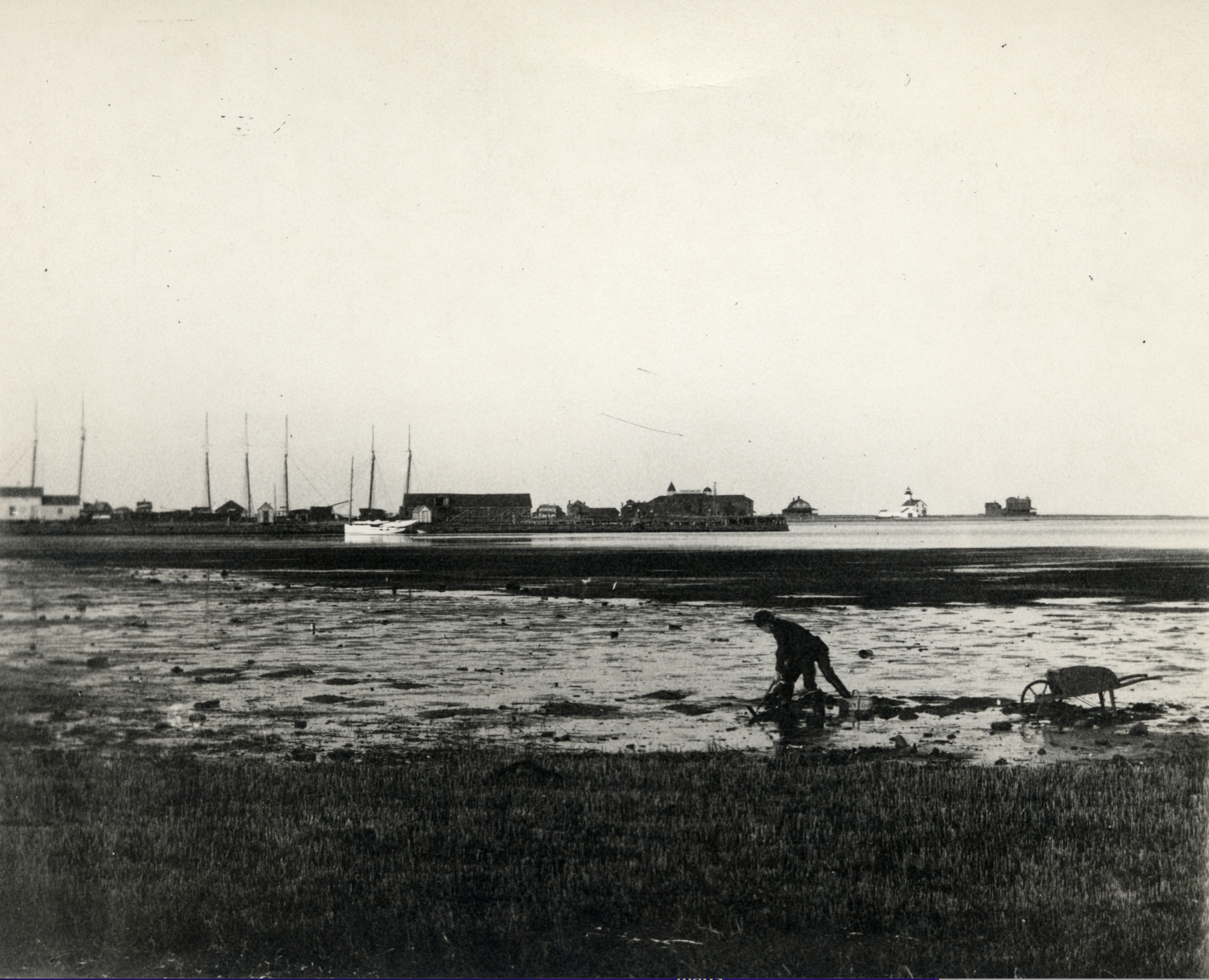
1900 Shoreline
1900 Photo of man clamming along the Washington Street Shore. Commercial Wharf and Brant Point are in the background. Courtesy of the Nantucket Historical Association.
-
![]()
1920s Shoreline
Aerial view of the Washington Street shore and nearby settlement, from the Creeks to Commercial Wharf. 1926 photo Courtesy of the Nantucket Historical Association.
-
![]()
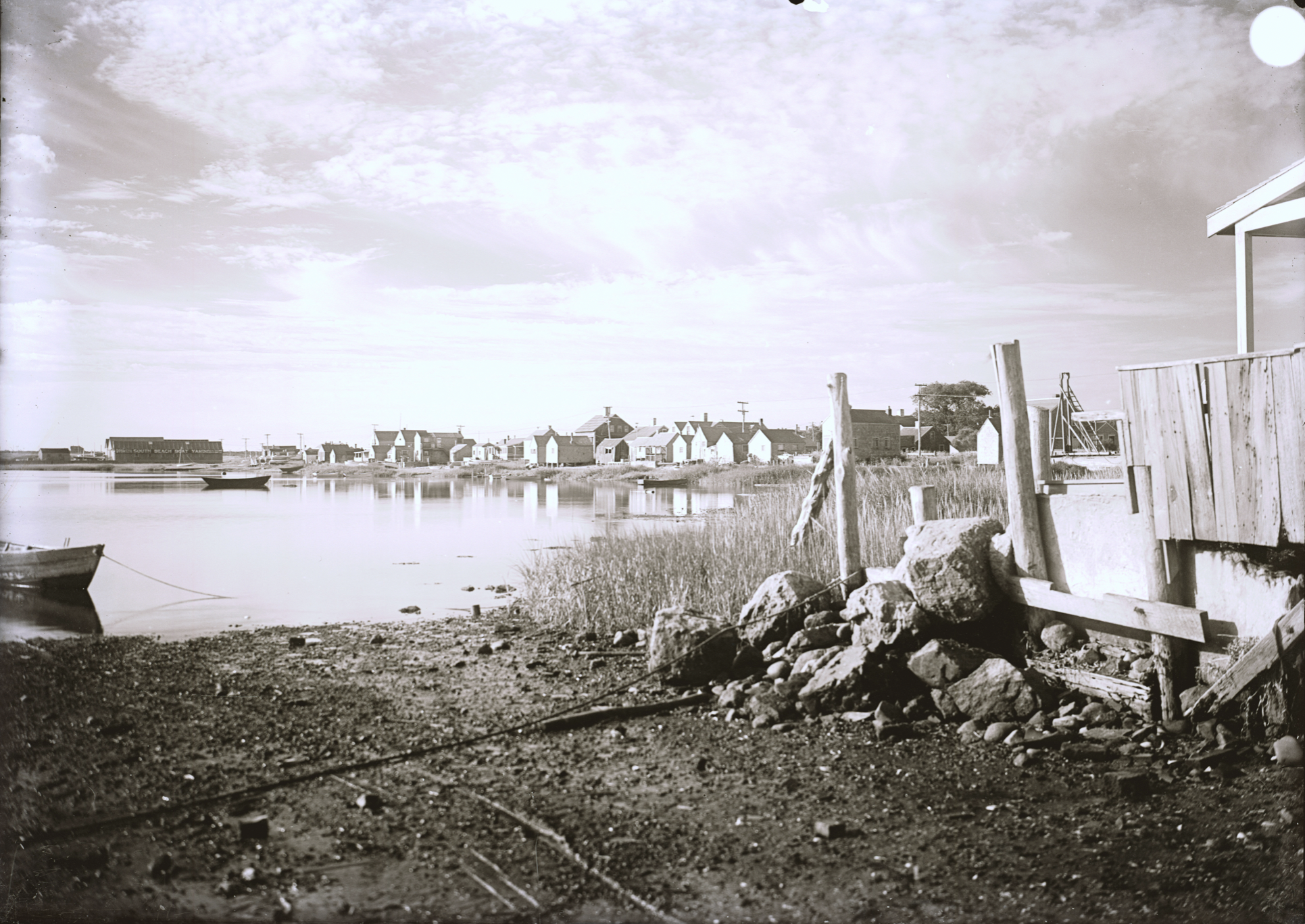
1930s Shoreline
Washington Street shore from Commercial (Swain's) Wharf (RB) South Beach Boat Yard building visible far left. Dory boat tied in the water, wagon tracks leading from the harbor water. . South Beach Boat Yard exists between 1924 and 1952. Similiar image shows two dory boats pulled up in this spot and became a popular postcard image by Gardiner titled “Dory Mates”. Courtesy of the Nantucket Historical Association.
-
![]()
1940s Shoreline
Sandy shores have overtaken the salt marsh-leaving only remnants of root filled peat behind. Nantucket town from the boatyard. Washington Street visible. 1940s photo Courtesy of the Nantucket Historical Association
-
![]()
1940s Sandy Shoreline
Looking south on Washington Street shore, showing houses and numerous beached boats. 1940s photo Courtesy of the Nantucket Historical Association.
-
![]()
Winter Storm
1940s Snapshot of snow on Washington Street with wires down. (Courtesy of the Nantucket Historical Association)
-
![]()
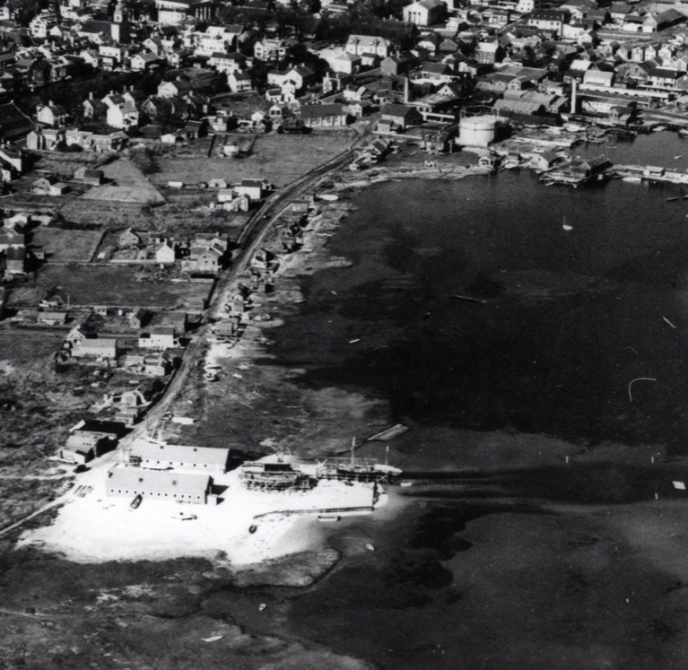
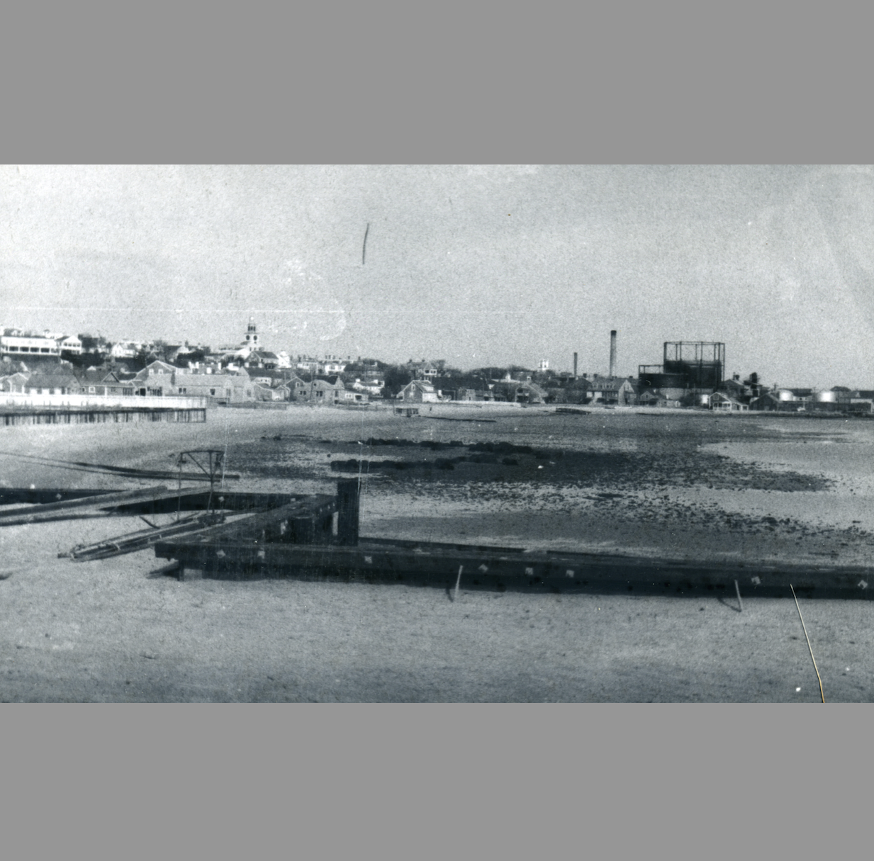
Town Parking Lot
1968 Southeast view from the Unitarian Church, showing Washington Street, the Nantucket Shipyard, and the Creeks. The bare ground in the middle became the town pier parking lot. (Courtesy of the Nantucket Historical Association)


Present
-
![]()
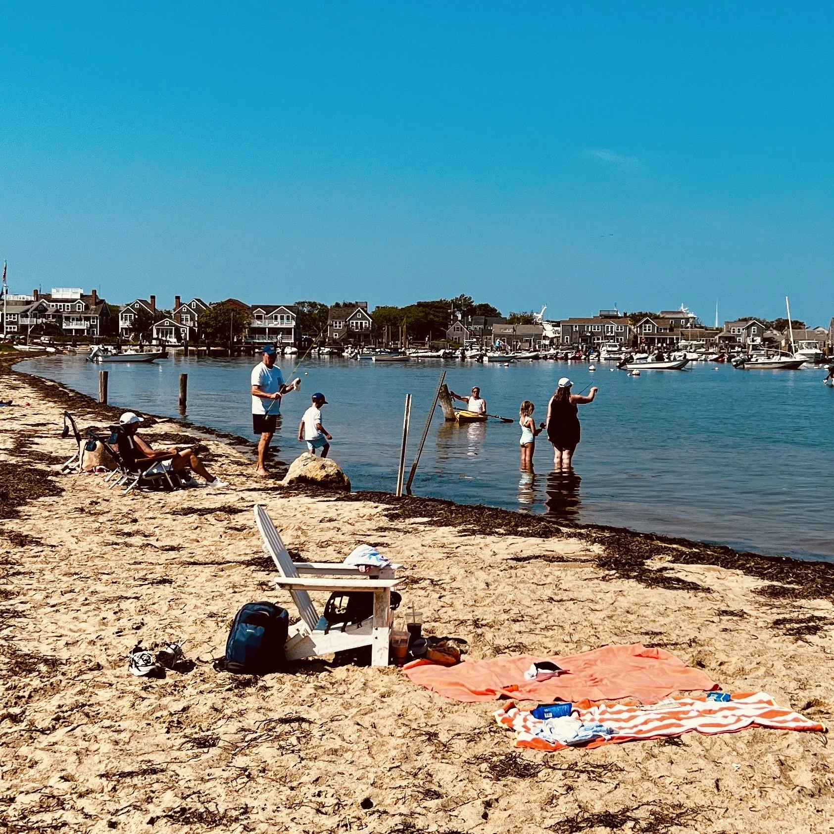
Beloved Beach in Town
Francis Street Beach today features a sandy shoreline conveniently located near town, with seasonal kayak and paddle board rentals. Complimenting Children’s Beach on the north side of town, Francis Street Beach, running roughly parallel to Washington Street is less developed and crowded than Children’s, but offers a spectacular view of Town Pier and the Harbor. (Photo by Will Kinsella)
-
![]()
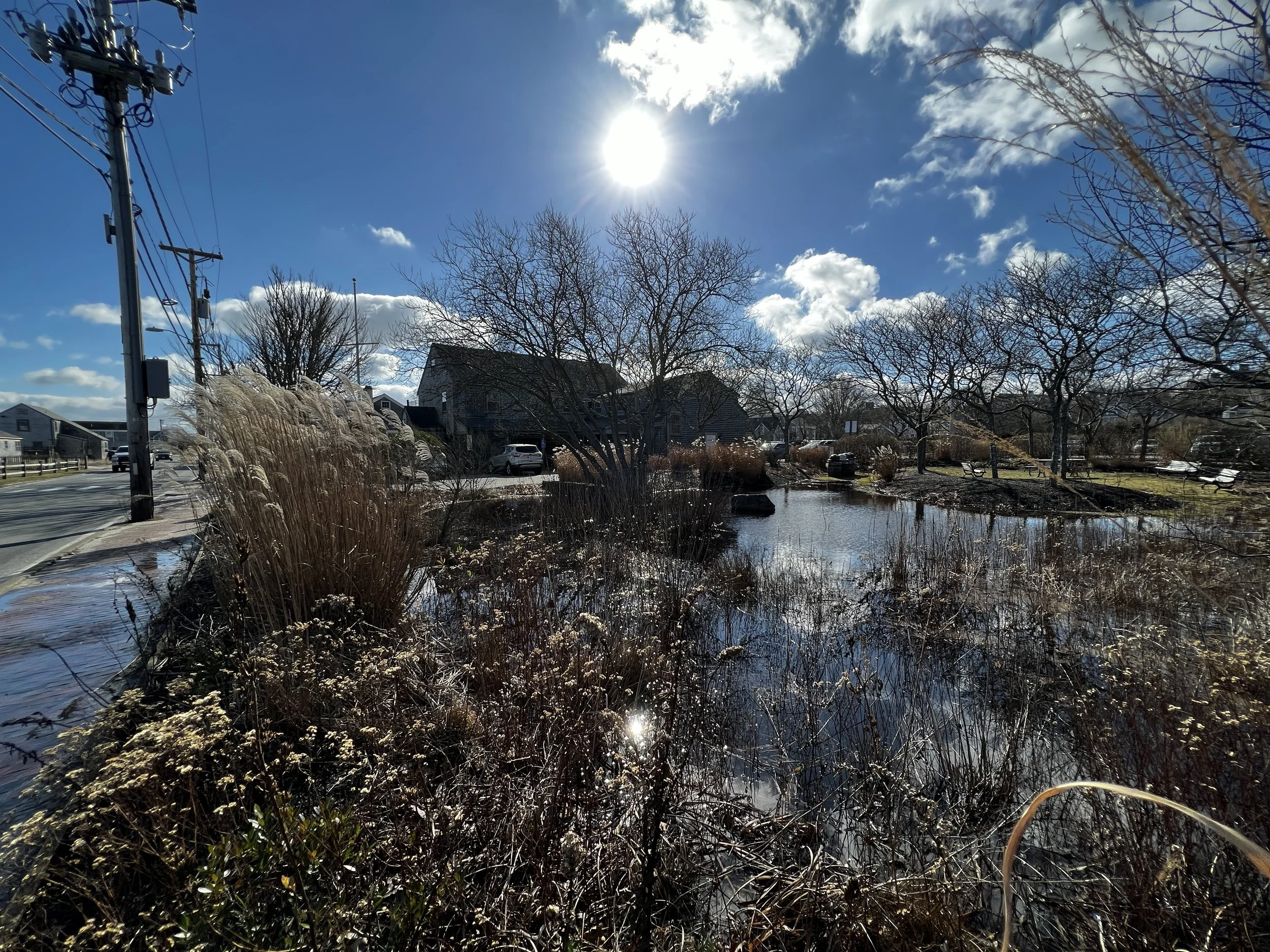
Sunny Day Flooding
Unlike flooding associated with downpours, this flooding comes as a result of really high tides. All of the waterfront properties on Washington are in the 100-year flood zone and are prone to flooding. This includes several government offices and other key buildings that are deemed critical. January 2023 High tide. (Will Kinsella Photo)
-
![]()
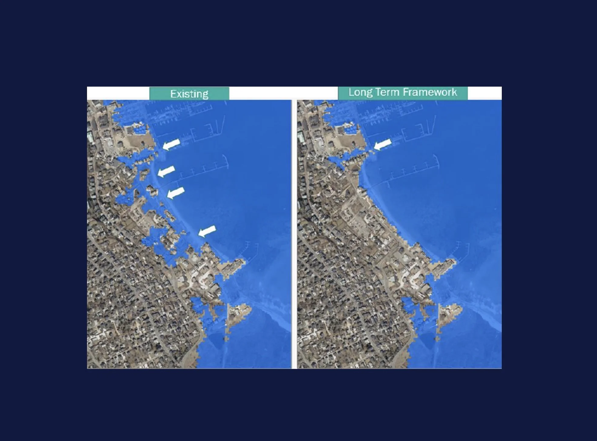
Planning for Protection
Under its current conditions, the Washington Street corridor experiences frequent flooding and by 2030 there could be 50 days a year that it will be impassible. Collaborative planning efforts incorporate a variety of elevated features which would reduce flood impacts and prolong the use of the road.
-
![]()
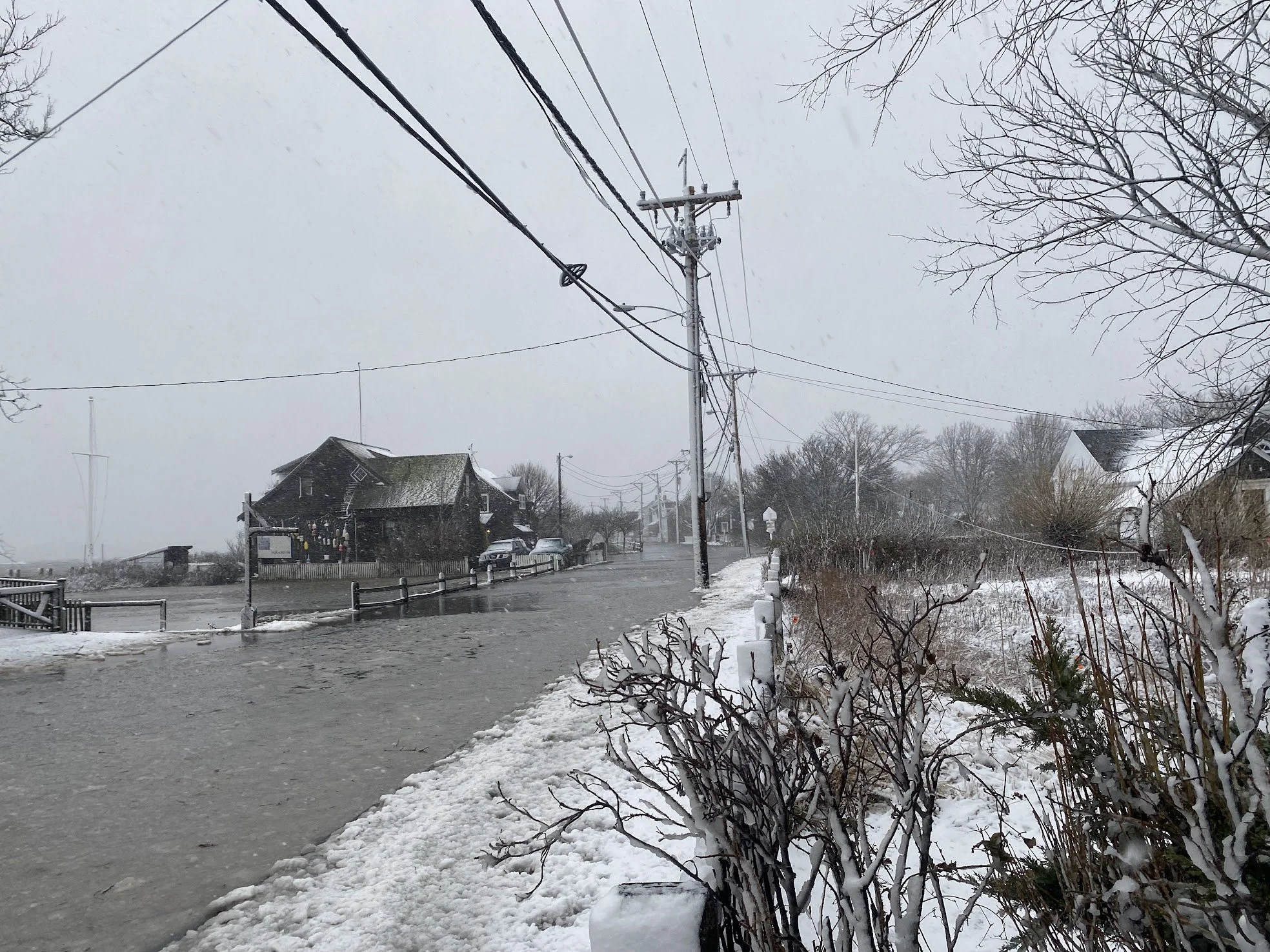
Nor'Easter
Washington Street is the main artery for traffic in and out of town and is the only corridor wide enough for large trucks bringing food and fuel to every other part of the Island. January 29, 2022 Nor'easter. Photo courtesy of Kim Rose
-
![]()
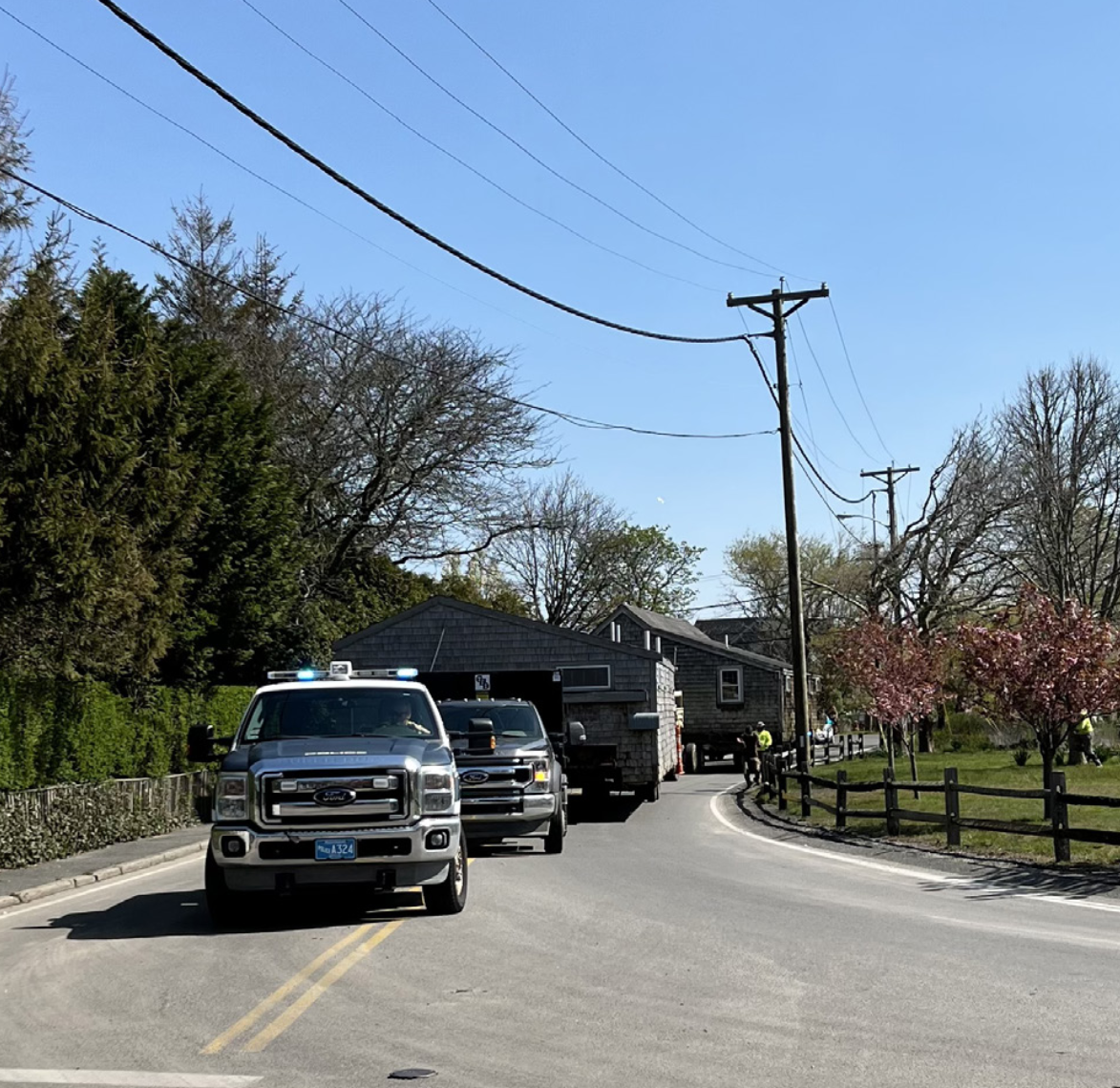
Architectural Salvage and Resilience Planning
Nantucket Island School of Design & the Arts (NISDA) occupied a small cluster of cottages at 71 Washington Street, on the corner of Francis Street, but they were always vulnerable to flooding. In recent decades, that flooding has grown worse and more frequent. NISDA made the decision to sell their Washington Street property to the Town (to widen the road) and the Nantucket Land Bank, to aid in adaptation and coastal resilience planning. The cottages closest to the water—those most heavily damaged by flooding—were demolished, but in May 2022, the two remaining cottages were moved to 55 Wauwinet Road. (Photo courtesy of NISD)
Future(s)
These conceptual renderings are illustrative of potential long-term resilience strategies and do not represent final designs or near-term recommendations. These are presented to help inform community discussions about long-term adaptation.
The future remains up to us.
-
![]()
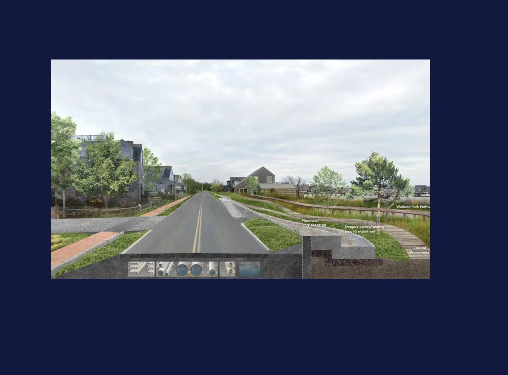
Coastal Resilience Plan Conceptual Design
Conceptual design of a roadway section of the Downtown Neighborhood Flood Barrier, which is intended to reduce risk from future high tide flooding and storm surge. This is one way that a road elevation could serve as a barrier to flooding and be integrated within the character and experience of the Downtown streetscape. (Coastal Resilience Plan page 153)
-
![]()
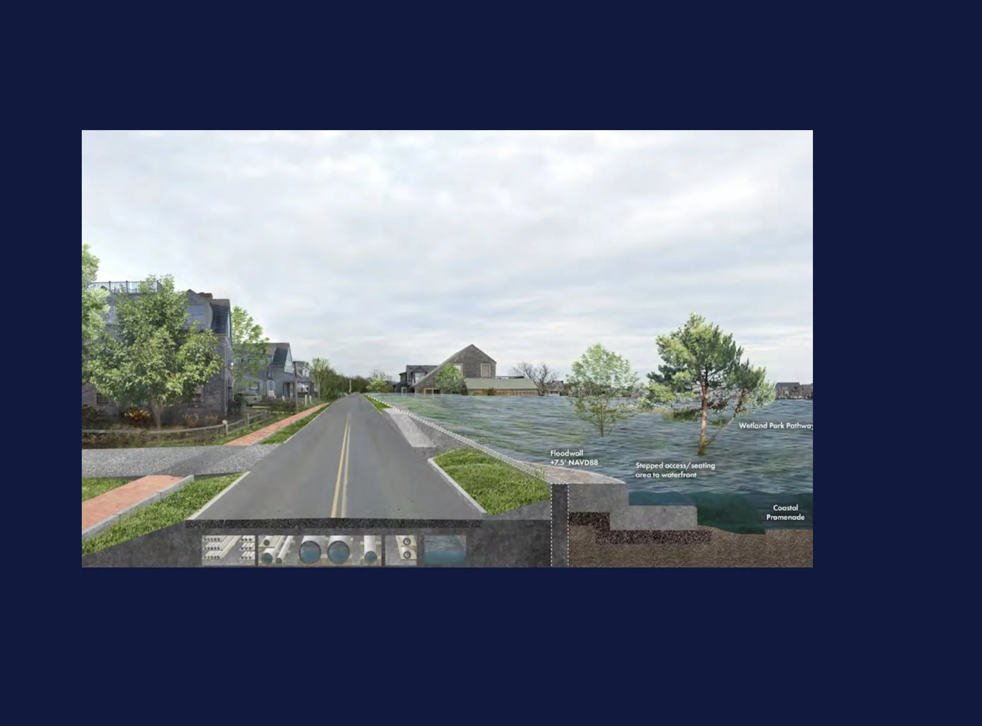
Coastal Resilience Plan Conceptual design-Flood Event
Conceptual design of a roadway section of the Downtown Neighborhood Flood barrier during a flood event. The barrier is designed to protect against future flooding up to 7.5' NAVD88. (Coastal Resilience Plan page 153)
-
![]()
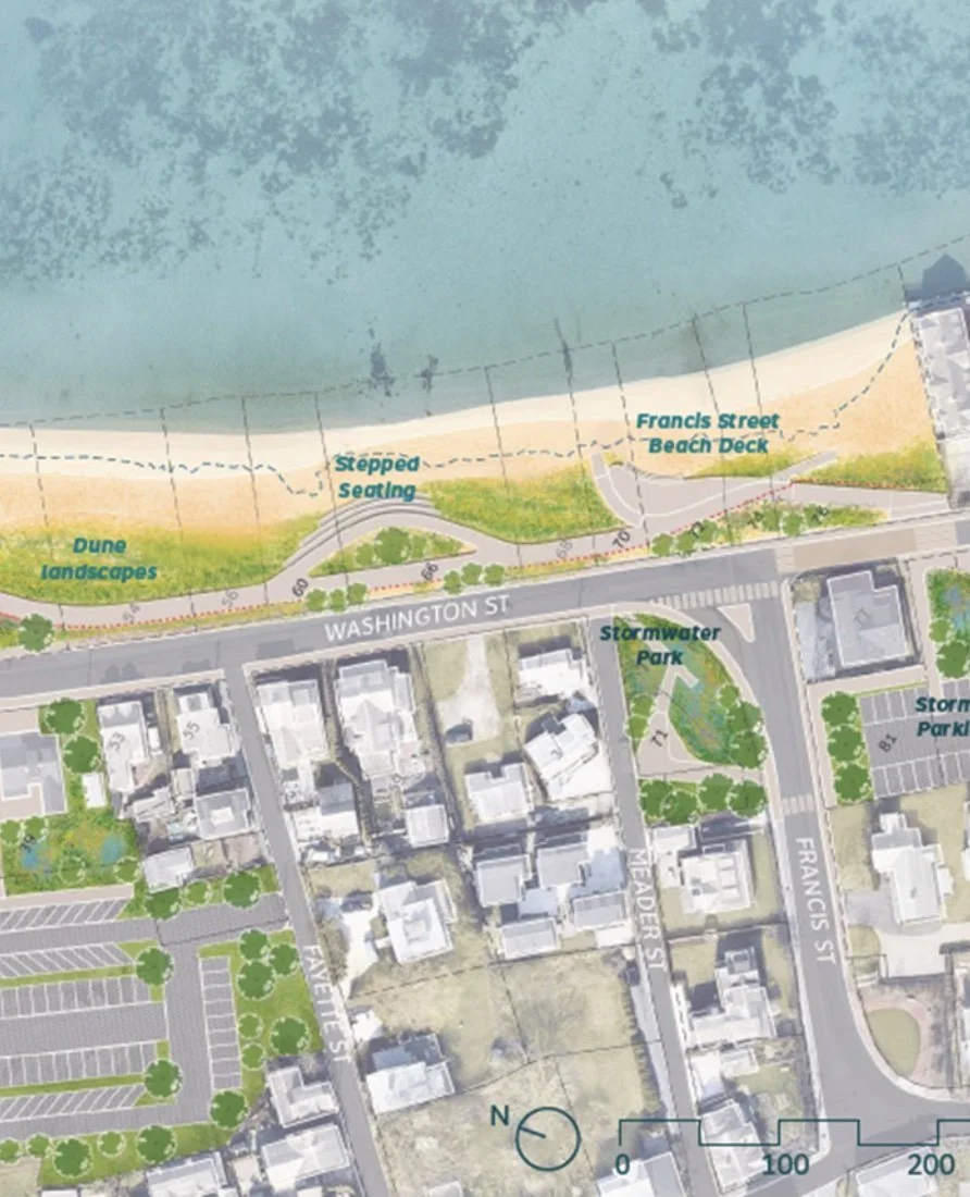
Washington Street Framework Plan (Image 1 of 2)
The Land Bank's Washington Street Framework Plan incorporates nature-based solutions, including dune restoration and a stormwater park, in addition to gray infrastructure elements such as a bike path, a board walk, and tide gates. (cont.)
-
![]()
Image 2 of 2
This comprehensive and holistic water management strategy will further the Land Bank’s goal of enhancing resilience, access, and native ecosystems at the water’s edge. Courtesy of the Nantucket Land Bank.
-
![]()
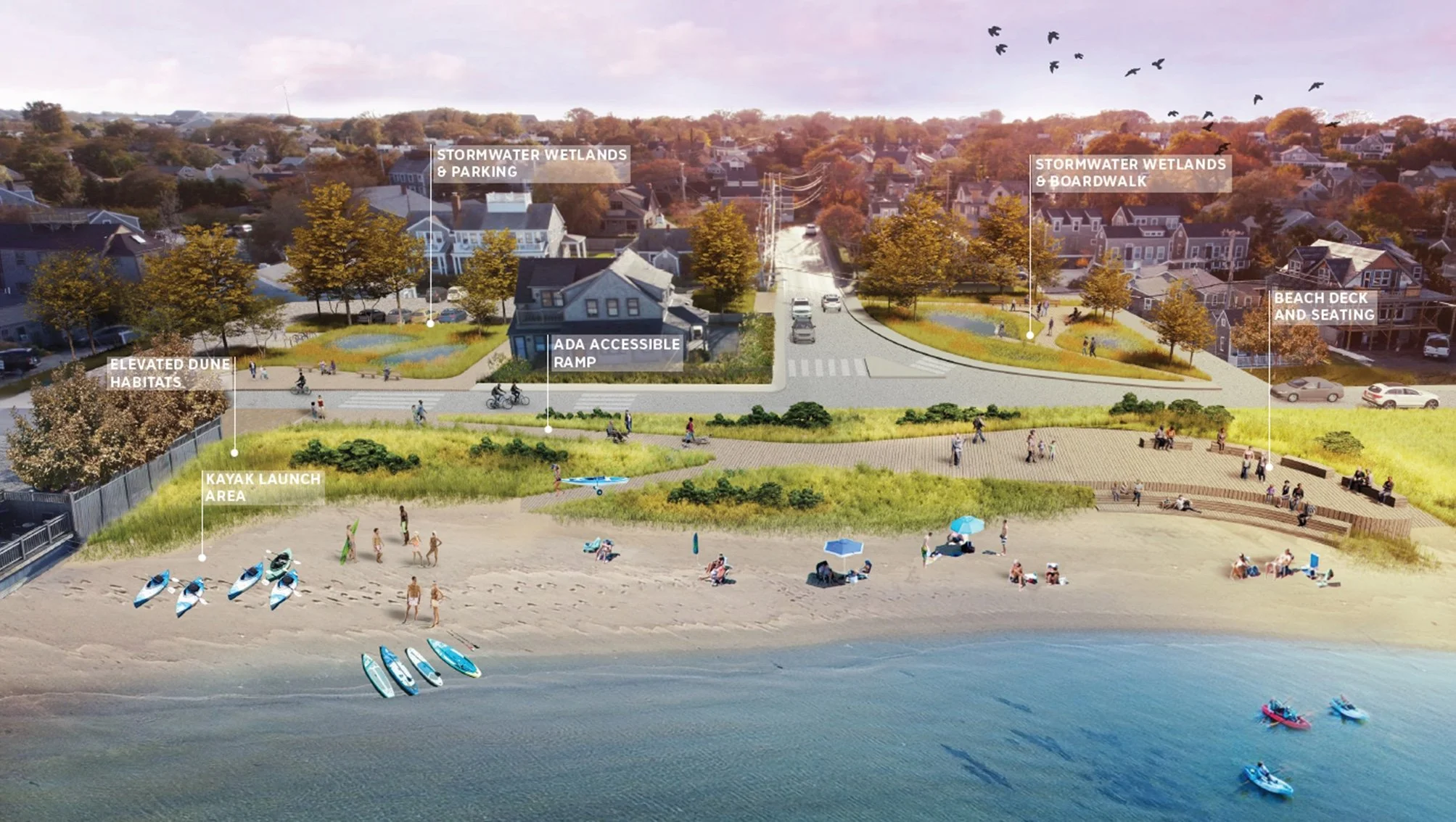
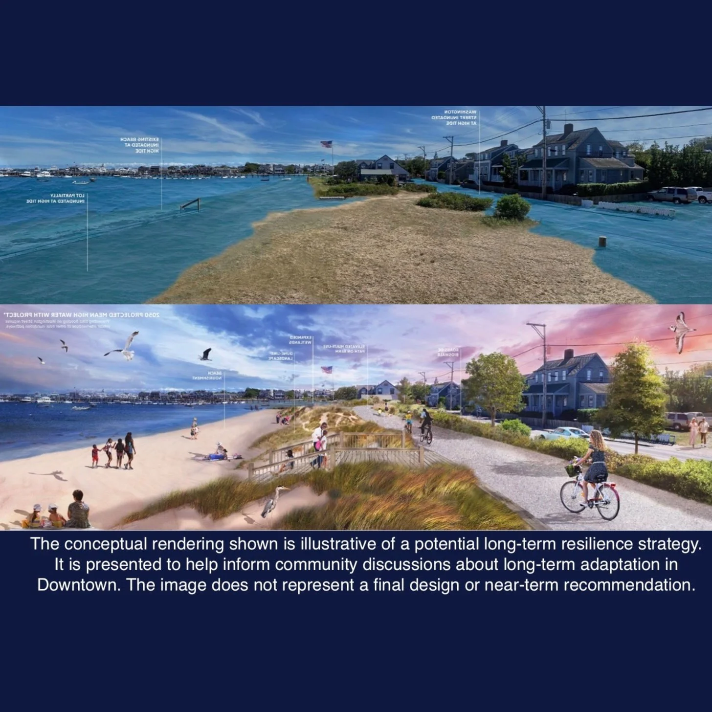
A Resilient Francis Street Beach
The conceptual rendering shown is illustrative of a potential long-term resilience strategy at Francis Street Beach. On the waterside, the design includes a flood protection structure embedded beneath an elevated multi-use path and coastal dunes. Inland of Washington Street, the stormwater wetland park would help mitigate inland flooding. On both sides of Washington Street, there would be improved public access via the accessible deck and boardwalks.
-
![]()
Modeling for Resilience, Access and Usability
This conceptual design incorporates public recreation, habitat protection and improved multi-modal access to and from the downtown corridor, while the elevated features will serve as a natural barrier to high tide flooding. Courtesy of the Nantucket Land Bank
-
![]()
Holistic Design Concepts
Conceptual stormwater wetlands provide open space for recreation, native plants and wildlife habitat, as well as protection for our aquifer. Courtesy of the Nantucket Land Bank.