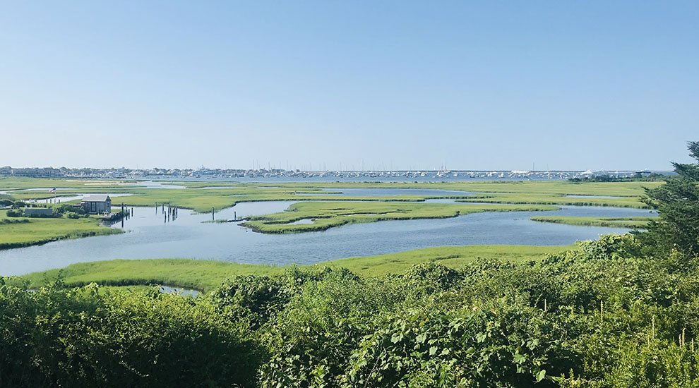
The Creeks
The Creeks provide an example of what the entire Coastal Resilience Walk coastline might have once looked like. This publicly accessible open space, owned by both private and public entities, provides many benefits to the Nantucket community, including aquifer protection, wildlife habitat, recreation, and increased property values. The Creeks, like much of the island’s open space, will be at risk as sea levels continue to rise and erosion worsens. Although scarred by WPA mosquito ditches and dissected by the former railroad tracks (now a side path for non-vehicular traffic), the Creeks remain Town’s least disturbed waterfront. This important saltmarsh filters runoff from Orange and Pleasant Streets, as well as conversely offering wave attenuation during storm events. At the wetland area known as The Creeks, a long-term resource management plan is recommended by the Coastal Resilience Plan to determine the best course of action, including accretion and salinity modeling to determine if long-term wetland enhancements may be necessary or appropriate.
Photo by Will Kinsella
Past
-
![]()
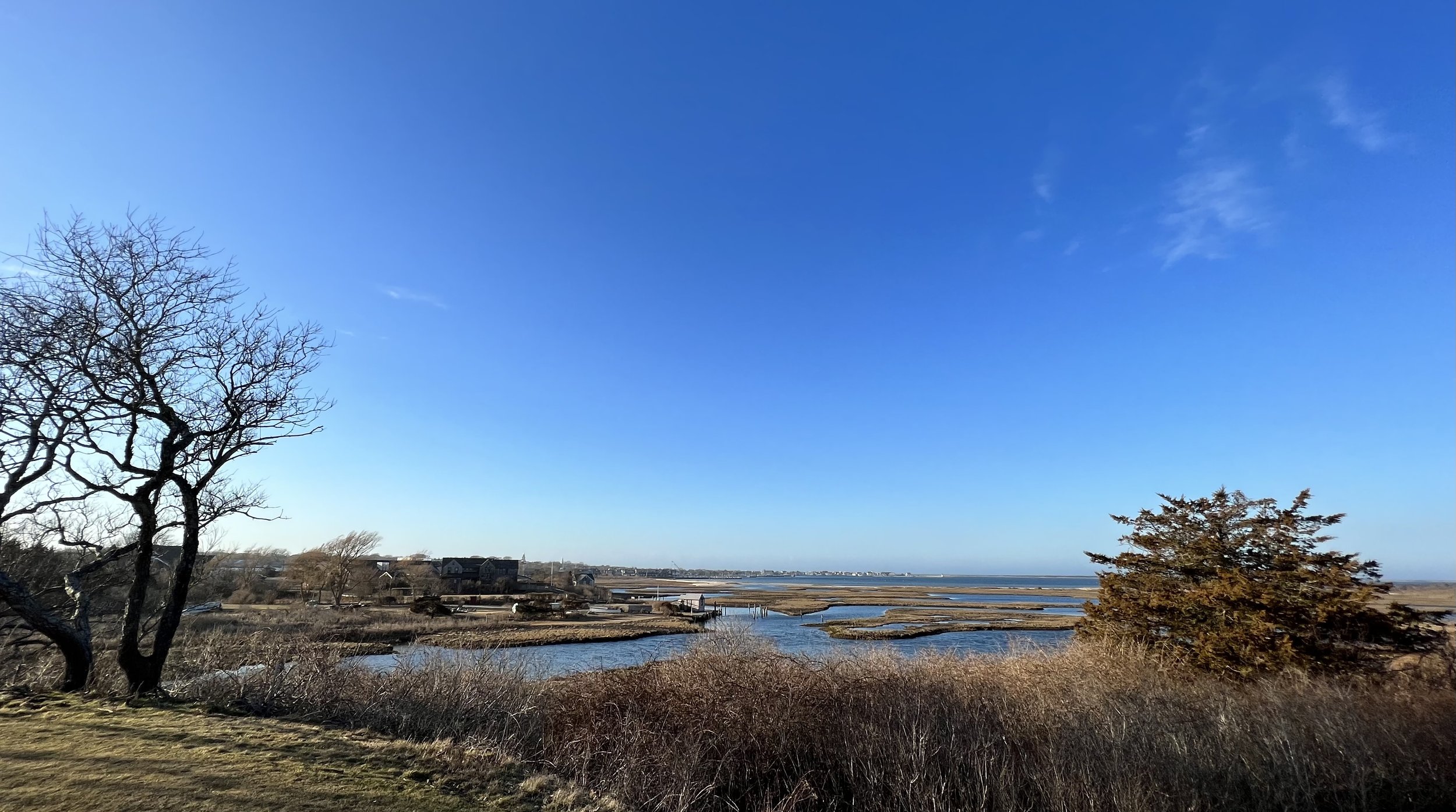
1930s Town View
1930s Town View from Poverty Point, view "A" , landscape of marsh, houses and sky looking north. Envelope marked "RB P." The Nantucket Shipyard is on the right. Goose Pond Lane is on the left. (Courtesy of the Nantucket Historical Association)
-
![]()
A Wetland Disturbed
1957 Fair Street, Orange Street, Union Street, and Washington Street extension showing the large buildings at the Nantucket Shipyard, as well as Consue Spring. Flight scale 1 : 3600. (Courtesy of the Nantucket Historical Association)
-
![]()
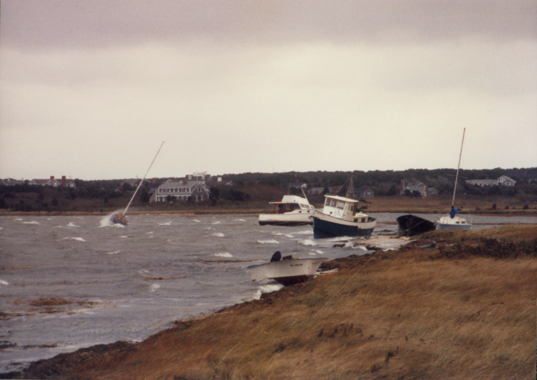
Hard Ashore
Aftermath of the 1991 "No Name Storm" of November 1991, showing sailboats and two small motor vessels washed ashore near the Creeks. (Courtesy of the Nantucket Historical Association)
-
![]()
Open Pastures
The open landscape off lower Orange Street near Our Island Home and the Creeks, with a few cows grazing. Monomoy is in the distant background. (Courtesy of the Nantucket Historical Association)


Present
-
![]()
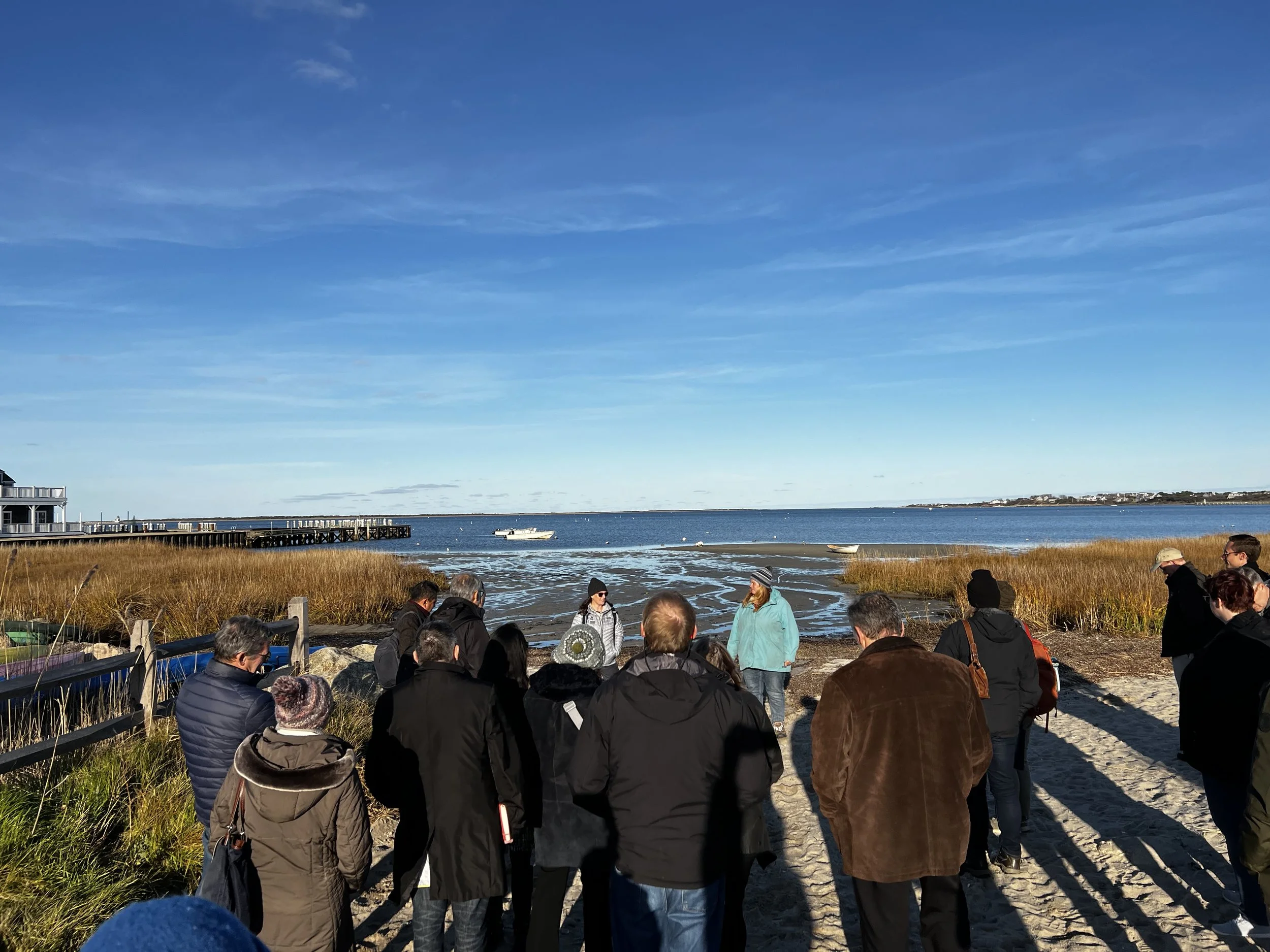
Cultural Heritage in the Anthropocene Tour
Doctors Karberg and Bois lead a tour during the "Cultural Heritage in the Anthropocene" expert workshop and symposium co-hosted by the Nantucket Historical Association, National Park Service and the Rome-based International Centre for the Study of the Preservation and Restoration of Cultural Property. The symposium provided a community forum to explore the latest international and domestic efforts to address the impacts of climate change on cultural heritage and historic materials.(Will Kinsella photo)
-
![]()
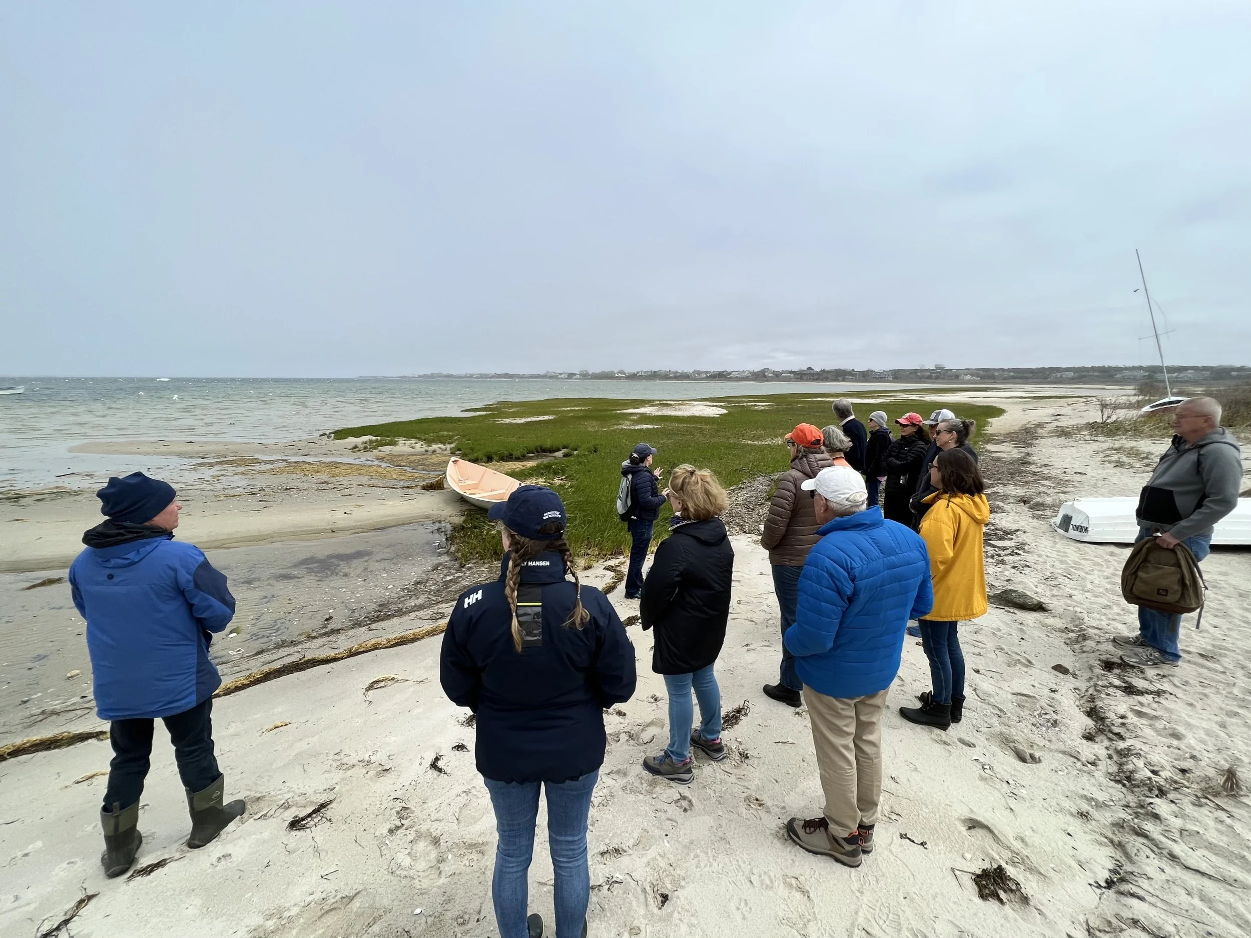
Coastal Ecology Class
The Nantucket Conservation Foundation (NCF) and Linda Loring Nature Foundation (LLNF) offer a five-week Nantucket Coastal Ecology course. This course provides a broad education in the ecology and management of Nantucket Island’s coastal habitats. Designed as a hybrid course, students participate in lectures paired with in-person field trips exploring coastal areas around Nantucket. The LLNF-NCF 2022 Coastal Ecology Class began the Field Trip portion of their studies learning about the important roles the Creek's coastal wetlands perform from Doctors Bois and Karberg. Learn More about the Coastal Ecology Class. (Photo by Will Kinsella)
-
![]()
Living Shorelines
The Creeks and Consue Springs are one of the remaining natural systems (salt marsh) in the downtown area that could be utilized to alleviate future impacts of flooding. These intertidal habitats are essential for healthy fisheries, coastlines, and communities—and they are an integral part of our economy and culture. They also provide essential food, refuge, or habitat for many species of birds which forage in salt marshes. Photo courtesy of the Nantucket Land Bank
-
![]()
Coastal Blue Carbon
Healthy coastal habitat is not only important for seafood and recreation, it also plays an important role in reducing climate change. Salt marshes, mangroves, and seagrass beds absorb large quantities of the greenhouse gas carbon dioxide from the atmosphere and store it, thus decreasing the effects of global warming. These types of habitat are known as carbon sinks and contain large stores of carbon accumulated over hundreds to thousands of years. Using more scientific lingo, coastal blue carbon is the carbon captured by living coastal and marine organisms and stored in coastal ecosystems.
-
![]()
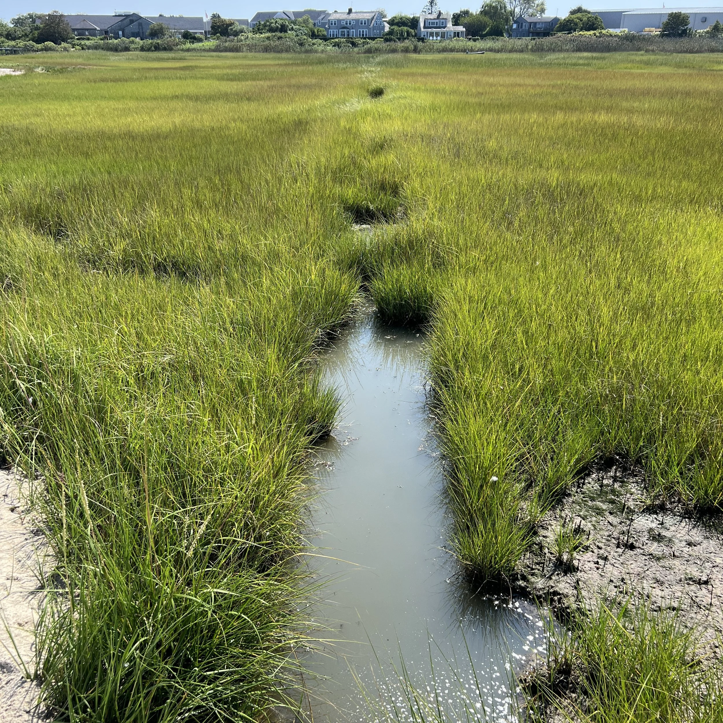
Mosquito Ditches
Mosquito ditches were shallow, narrow, hand-dug ditches designed to remove standing water from the marshes to prevent the breeding of mosquitoes most widely practiced in the 1930s during the Depression. The New Deal public works programs of the era, such as the Works Progress Administration (WPA) and the Civilian Conservation Corps (CCC), supported grid-ditch draining projects, not only to control mosquitoes but also to provide employment for millions of unemployed workers. These programs were so extensive that by 1938, 94% of the tidal marshes along the New England coast had been ditched. These programs resulted in the ditching of many low marsh areas that did not breed mosquitoes, which caused a decrease in the fish and birds in those marshes while not effectively controlling mosquitoes. (Photo by Will Kinsella)
-
![]()
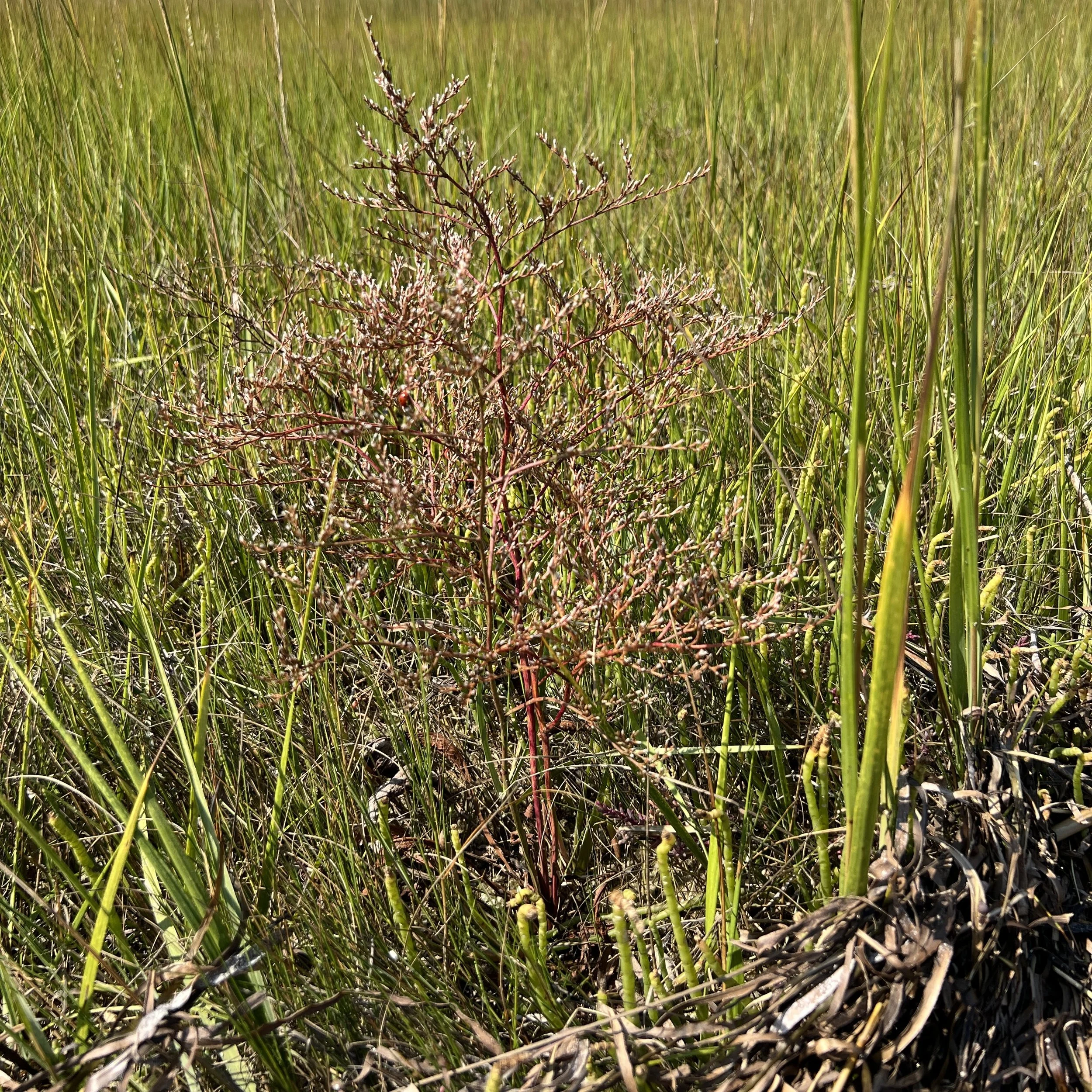
Ecosystem Services
Salt marshes are among the most productive ecosystems in the world. They provide wildlife habitat, produces large quantities of plant and animal biomass, exports food to nearby coastal food webs, protects the coastal zone from floods, and absorbs some water-borne contaminants. Sea lavender, cordgrass, glasswort and washed up eelgrass pictured here in September. (Photo by Will Kinsella)
-
![]()
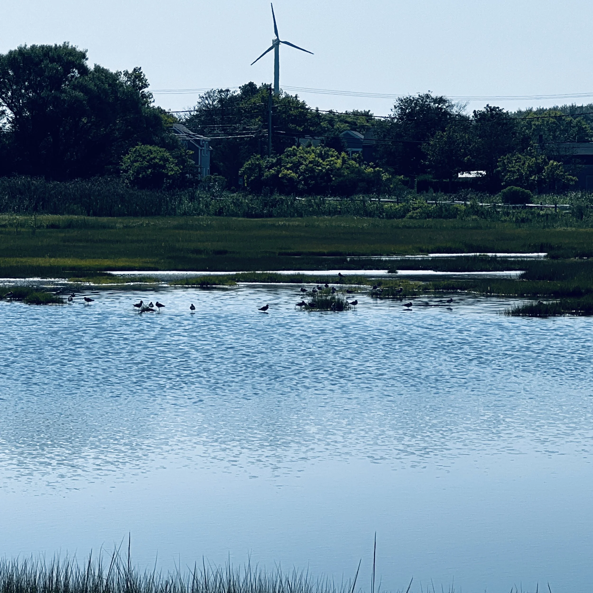
Unique Habitats
Salt marshes are globally rare habitat with less than 50,000 km2 worldwide and of that as much as 90% is likely to be underwater by the end of the century.. According to a new NASA-led study, the world has lost 561 square miles (1,453 square kilometers) of salt marshes over the past 20 years. As sea levels rise coastal salt marshes may move inland to areas of higher ground, through a process known as “marsh migration.” But barriers such as bulkheads, berms, seawalls, and roads can block this migration. Without room to shift away from rising seas, salt marshes are at risk of disappearing. (Photo by Will Kinsella)

Future(s)
These conceptual renderings are illustrative of potential long-term resilience strategies and do not represent final designs or near-term recommendations. These are presented to help inform community discussions about long-term adaptation.
The future remains up to us.
-
![]()
Old Creeks
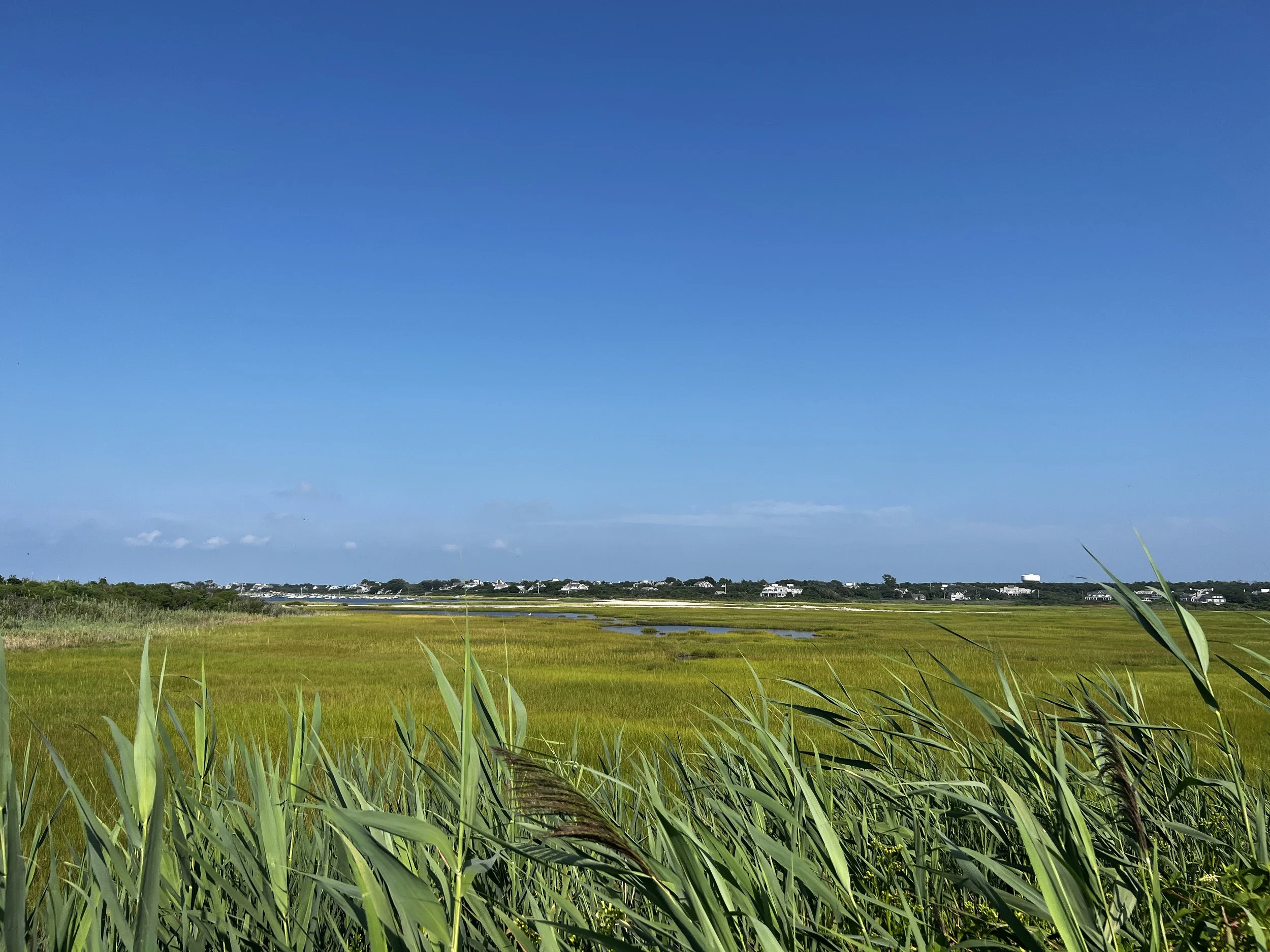
Wetlands make up much of the open space on Nantucket and sea level rise will alter these environments over time. Up to 645 additional acres of wetland resource areas compared to today may be submerged by mean monthly high water by 2070, leading to habitat changes and potential loss in these areas. (Photo by Will Kinsella)
-
![]()
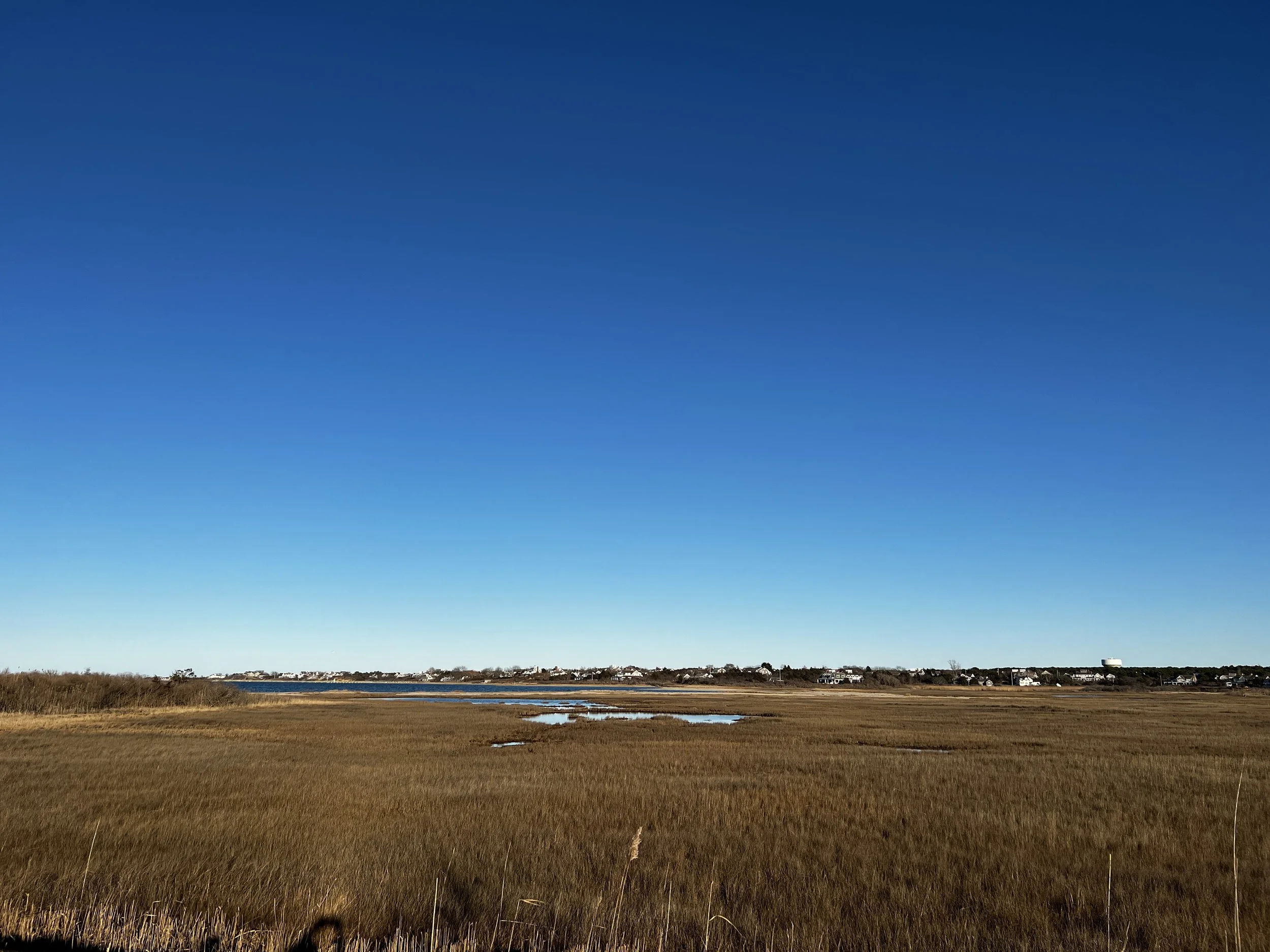
Migrating Marshes
By 2070, up to 1,239 acres of protected open (7% of island-wide open space) space could be lost or altered due to erosion. 2,878 acres of open space (16% of island-wide open space) will be impacted by the flooding during mean monthly high water, though some of these areas may be lost to erosion prior to being exposed to tidal flooding. Marshes will need to migrate landward and increase their elevation so they can keep up with sea level rise. (Photo by Theo Kinsella)
-
![]()
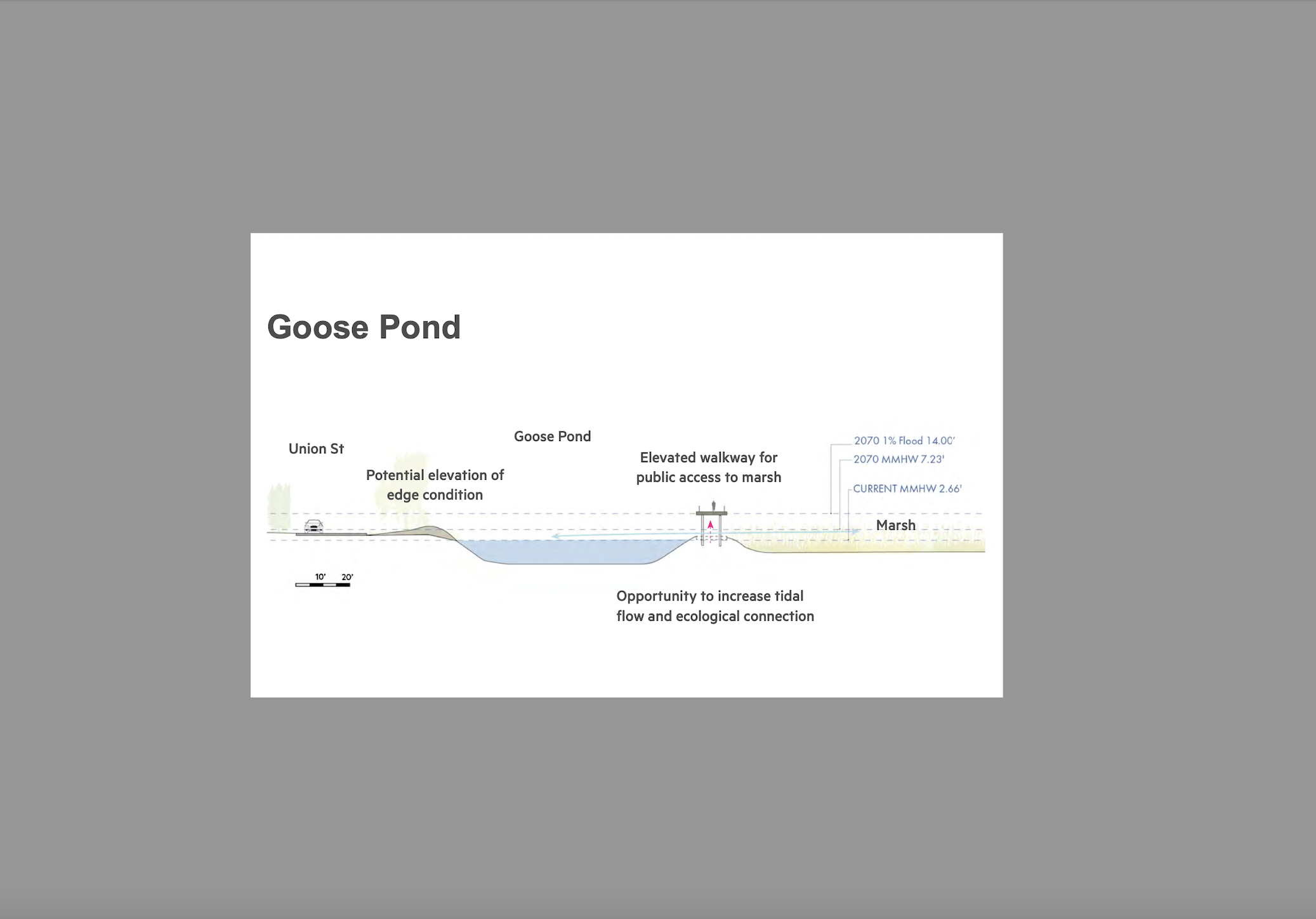
Conceptual Plans
At the wetland area known as The Creeks, a long-term resource management plan is recommended to determine the best course of action, including accretion and salinity modeling to determine if long-term wetland enhancements may be necessary or appropriate. Replacing the former railroad berm with an elevated walkway would allow water and wetland species to migrate between the Creeks and Goose Pond (Consue Spring). (CRP p. 146)
-
![]()
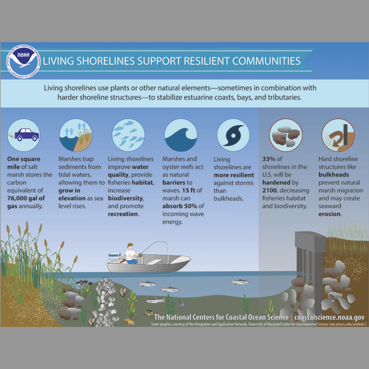
Living Shorelines
“Living shorelines” use wetland plants, natural structures, and shellfish as breakwaters so wave energy is absorbed and erosion is reduced. These natural environments can also help to protect coastal areas from regular flooding and storm damage.